Tarf and Tilt Hills: Beinn a' Chlo (Carn Liath (181), Braigh Coire Chruinn-bhalgain (66) and Carn nan Gabhar (32))
Walk date: 14/10/06
My Munro #'s: 93, 94 and 95
Pronunciations - translations - heights:
Byn a glow - Hill of Mist
Kaarn lee-a - Grey Hill - 975m
Bray corrie kroon vaalakan - Upland of the Corrie of Round Blisters - 1070m
Kaarn nan gower - Hills of the Goats - 1121m
Statistics:
Duration - 10:00 - 19:15
Distance - 23.2km
Weather - dry but in cloud all day, some high winds when exposed.
Team - with Sonia
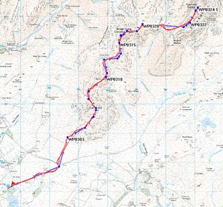
Plotted route in blue, taken route in red:
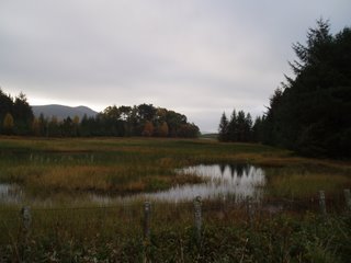
Let's get started then: Loch Moraig by the car park:
By 700m, all views for the day were effectively gone:
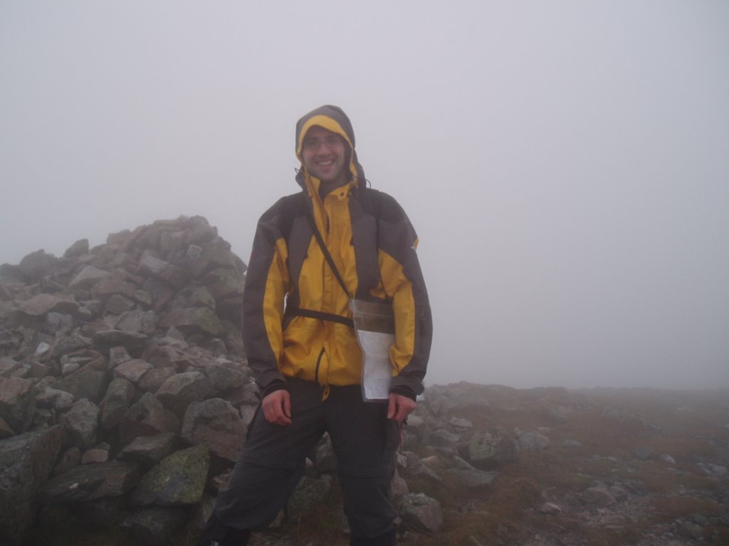
The stunning top of Carn Liath:

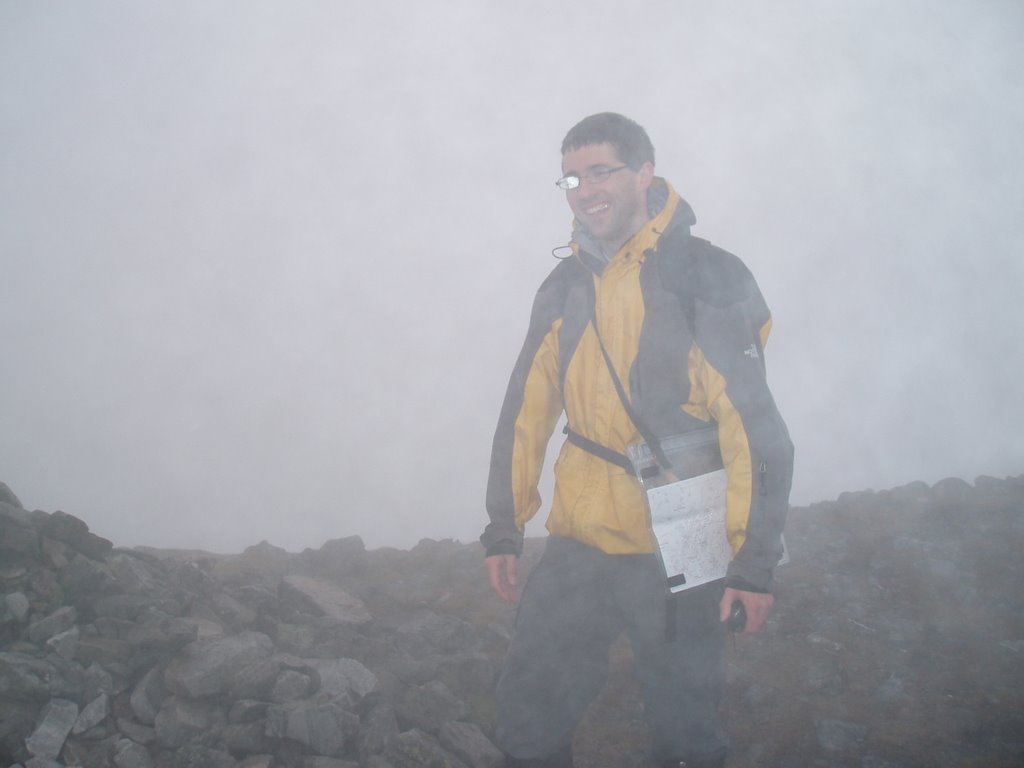
The incomparable top of Braigh Coire Chruinn-bhalgain:
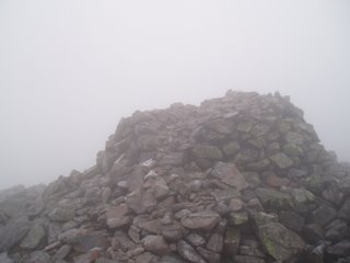
But the ultimate, the sheer splendor of Carn nan Gabhar:
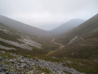
A view! SE down toward Allt na Beinne Bige:
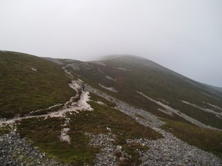
Spot the Sonia; S descends Braigh Coire Chruinn-bhalgain:
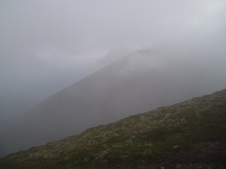
Heading back & still one to go, Carn Liath through mist:
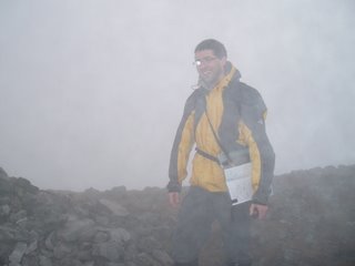
The mist returning, and Sonia:
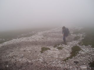
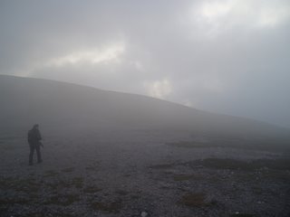
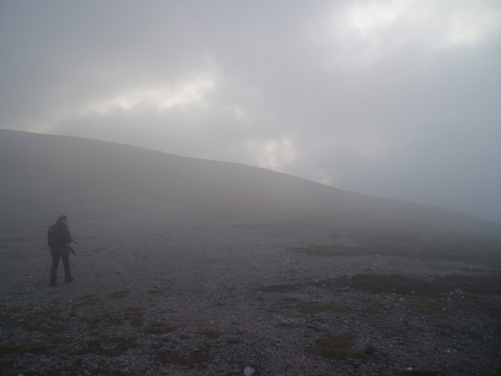
A rare sighting of the endangered 'hiker in the mist':
Saturday. This was a long day. We calculated 6-8 hours for the walk, so we had to get up at 06:00 to leave by 07:00 and drive the almost 3 hours to Blair Atholl so we could be walking by 10:00 and, the plan was, be back by 18:00.
Well, we managed the 10:00 start at least. Making our way from the 'car park' (patch of grass at cattle grid) by Loch Moraig off ENE towards some interesting little huts that mark the start of a kilometre of bog at the foot of the slopes of Cairn Liath. Once the bog has been traversed, the path up Carn Liath is one unrelenting slog and there's nothing to do but get on with it. By 700m at the latest we were in thick cloud and this was to remain essentially unchanged for the rest of the day. When the inclined finally eased off the summit soon came, but given the total lack of views we soon left it behind us, taking the gentle wide downward slopes to the north-west and being very thankful for the GPS given visibility below 10m.
The walking was easy enough for a while here, although it annoyingly involved some ascending for Beinn Mhaol, a non-Munro top! Ridiculous!! Tricky navigation again here, but soon we were down at the tight turn by Allt Coire Chruim ascending our second Munro, the ridiculously named Braigh Coire Chruinn-bhalgain or 'upland of the corrie of round blisters', riighht. The top here was reached without much trouble and we sat for ten minutes having a spot of lunch in the shelter of the cairn. However, I knew we were starting to slip on our schedule so I had us moving on pretty quickly, flat for a while E then NE along the broad summit ridge before a sharp and unexpected turn E down steepish slopes towards Bealach an Fhiodha. This turn was so unexpected that we had to confirm the GPS directions by compass, and upon returning Sonia and I built a mini-cairn to help our fellow hikers!
Once down at Bealach an Fhiodha, we finally could start the climb to our final Munro of the day, Carn nan Gabhar, which unfortunately, as time was getting tight, was also the highest of the day. There was at least a path on it, although at times there was more than one, which was rather less helpful and lead to lots of peering closely at the map. Anyway, we generally kept to the ones going more firmly upwards, and this worked out fine, taking us safely to the broad summit ridge. However, we only got to the summit ridge at 14:00, which was our original turn-around time, but being only 1km off the end, we wanted to press on, thinking that we'd be fine not to get down until 18:30, that 18:00 was just being conservative. Unfortunately, this 1km on the top was extremely slow-going, as it was mostly sharp and cumbersome boulder-rock underfoot, which took effort both physically and mentally, meaning that by the time we hit the top it was actually 14:25. This being the case, we turned on our heels and headed straight down along our approach route.
Already getting fatigued, it was on this descent that an old problem of Sonia's in her right foot returned, giving her intense pain as she walked. We could do nothing however, but press on and started climbing back up onto Braigh Coire Chruinn-bhalgain. The only nice point here is that we were nicely nudged along by the occasional unexpected, but very welcomed break in the cloud giving one of them dramatic views we'd read about!!
The tedium of repeating hills we'd already climbed then had to be repeated with the re-visiting of Carn Liath, up its very gradual and long north side. Fortunately, the descent was down the more sudden south end, although this came with the knock-on effect of causing further pain for S. With failing light, we eventually returned to the bog, finding a stable route through it by the wall featured on the map, which in turn took us back to the dream-like stability of the farm track. With the last embers of the day hanging in the sky, we returned to the wonderful refuge of our transportation, to a seat, a heater and lights! A wonderful and satisfying day out, although an extra hour of daylight would have been an absolute delight!
As it was late however, we made tracks to Pictlochry and the Moulin Hotel/Moulin Inn, which has its own brewery! This I had missed out on the previous weekend due to time constraints, and so it was wonderful to spend an hour in their crowded bar, enjoying a fine tasting pint of Moulin Old Remedial and a sublime meal of venison steak in berry sauce (S had the scampi and does not recommend it, although her chips were very nice!). Leaving at 20:45, we got back to the 'Deen at a reasonable 23:00!
Finally, the main reason this walk was so long was that our return path was just along our outward path, which in effect means that this was a five-Munro day (think about it...). There is a quicker route down which involves decending Airgiod Bheinn and then just walking along the farm track around the mountains, but this being deer-stalking season we had phoned the relevant hillphone for information and discovered that this route was off-limits. Incovenient, but better than being shot!
My Munro #'s: 93, 94 and 95
Pronunciations - translations - heights:
Byn a glow - Hill of Mist
Kaarn lee-a - Grey Hill - 975m
Bray corrie kroon vaalakan - Upland of the Corrie of Round Blisters - 1070m
Kaarn nan gower - Hills of the Goats - 1121m
Statistics:
Duration - 10:00 - 19:15
Distance - 23.2km
Weather - dry but in cloud all day, some high winds when exposed.
Team - with Sonia
Plotted route in blue, taken route in red:
Let's get started then: Loch Moraig by the car park:
By 700m, all views for the day were effectively gone:

The stunning top of Carn Liath:
The incomparable top of Braigh Coire Chruinn-bhalgain:
But the ultimate, the sheer splendor of Carn nan Gabhar:

A view! SE down toward Allt na Beinne Bige:

Spot the Sonia; S descends Braigh Coire Chruinn-bhalgain:

Heading back & still one to go, Carn Liath through mist:

The mist returning, and Sonia:
A rare sighting of the endangered 'hiker in the mist':
Saturday. This was a long day. We calculated 6-8 hours for the walk, so we had to get up at 06:00 to leave by 07:00 and drive the almost 3 hours to Blair Atholl so we could be walking by 10:00 and, the plan was, be back by 18:00.
Well, we managed the 10:00 start at least. Making our way from the 'car park' (patch of grass at cattle grid) by Loch Moraig off ENE towards some interesting little huts that mark the start of a kilometre of bog at the foot of the slopes of Cairn Liath. Once the bog has been traversed, the path up Carn Liath is one unrelenting slog and there's nothing to do but get on with it. By 700m at the latest we were in thick cloud and this was to remain essentially unchanged for the rest of the day. When the inclined finally eased off the summit soon came, but given the total lack of views we soon left it behind us, taking the gentle wide downward slopes to the north-west and being very thankful for the GPS given visibility below 10m.
The walking was easy enough for a while here, although it annoyingly involved some ascending for Beinn Mhaol, a non-Munro top! Ridiculous!! Tricky navigation again here, but soon we were down at the tight turn by Allt Coire Chruim ascending our second Munro, the ridiculously named Braigh Coire Chruinn-bhalgain or 'upland of the corrie of round blisters', riighht. The top here was reached without much trouble and we sat for ten minutes having a spot of lunch in the shelter of the cairn. However, I knew we were starting to slip on our schedule so I had us moving on pretty quickly, flat for a while E then NE along the broad summit ridge before a sharp and unexpected turn E down steepish slopes towards Bealach an Fhiodha. This turn was so unexpected that we had to confirm the GPS directions by compass, and upon returning Sonia and I built a mini-cairn to help our fellow hikers!
Once down at Bealach an Fhiodha, we finally could start the climb to our final Munro of the day, Carn nan Gabhar, which unfortunately, as time was getting tight, was also the highest of the day. There was at least a path on it, although at times there was more than one, which was rather less helpful and lead to lots of peering closely at the map. Anyway, we generally kept to the ones going more firmly upwards, and this worked out fine, taking us safely to the broad summit ridge. However, we only got to the summit ridge at 14:00, which was our original turn-around time, but being only 1km off the end, we wanted to press on, thinking that we'd be fine not to get down until 18:30, that 18:00 was just being conservative. Unfortunately, this 1km on the top was extremely slow-going, as it was mostly sharp and cumbersome boulder-rock underfoot, which took effort both physically and mentally, meaning that by the time we hit the top it was actually 14:25. This being the case, we turned on our heels and headed straight down along our approach route.
Already getting fatigued, it was on this descent that an old problem of Sonia's in her right foot returned, giving her intense pain as she walked. We could do nothing however, but press on and started climbing back up onto Braigh Coire Chruinn-bhalgain. The only nice point here is that we were nicely nudged along by the occasional unexpected, but very welcomed break in the cloud giving one of them dramatic views we'd read about!!
The tedium of repeating hills we'd already climbed then had to be repeated with the re-visiting of Carn Liath, up its very gradual and long north side. Fortunately, the descent was down the more sudden south end, although this came with the knock-on effect of causing further pain for S. With failing light, we eventually returned to the bog, finding a stable route through it by the wall featured on the map, which in turn took us back to the dream-like stability of the farm track. With the last embers of the day hanging in the sky, we returned to the wonderful refuge of our transportation, to a seat, a heater and lights! A wonderful and satisfying day out, although an extra hour of daylight would have been an absolute delight!
As it was late however, we made tracks to Pictlochry and the Moulin Hotel/Moulin Inn, which has its own brewery! This I had missed out on the previous weekend due to time constraints, and so it was wonderful to spend an hour in their crowded bar, enjoying a fine tasting pint of Moulin Old Remedial and a sublime meal of venison steak in berry sauce (S had the scampi and does not recommend it, although her chips were very nice!). Leaving at 20:45, we got back to the 'Deen at a reasonable 23:00!
Finally, the main reason this walk was so long was that our return path was just along our outward path, which in effect means that this was a five-Munro day (think about it...). There is a quicker route down which involves decending Airgiod Bheinn and then just walking along the farm track around the mountains, but this being deer-stalking season we had phoned the relevant hillphone for information and discovered that this route was off-limits. Incovenient, but better than being shot!
Labels: Beinn a' Chlo, Braigh Coire Chruinn-bhalgain, Carn Liath, Carn nan Gabhar, mountain, munro, Tarf, Tilt Hills
posted by George at 12:15
![]()
![]()


5 Comments:
Great pics!
Wow! You must be superfit old chap! By the way, here in Sheffield I live on Blair Athol Road!!!! But I thought the Scottish version had two L's at the end i.e. Blair Atholl
Einsturzende Neubauten? What the hell's that? Sounds like a neurological condition!
Ash - Cheers mate, I do wonder what these hills actually look like though!
YP - Good point about Atholl, will correct it (you can take the teacher out of the classroom, but...).
Nice name for a street, you should have a bottle of the Blair Atholl whisky on your shelves and scribble out one 'l'(although in actual fact it's distilled in Pictlochry).
I come from Barnsley my self so your Sheffield posts are most welcome. I particularly liked the driving one!
EN are a German experimental postrock band of which Rulls' and Cloud are big fans (as am I). You can't dance to it, but that's kind of the point. Their first gig was inside a bridge. More at neubauten.org. In fact, it could give you a neurological condition...
SHH - Thanks a lot. There's nothing better than the return after seeing these views. Especially if you have a cold one in the fridge!
Do you ever see dragonflies up in these places?
On occasion I actually do, especially on the low levels. More often however I am spotting frogs! These creatures are safe and well, they have just retreated to the higher ground!
Post a Comment
<< Home