The Tarf and Tilt Hills: Carn an Fhidhleir (Carn Ealar) (148) and An Sgarsoch (126)
Walk date: 28/08/10
My Munro #'s: 200 and 201
Pronunciations - translations - heights:
Statistics:
Duration - 10:15 - 18:00
Distance - 44.9km
Total ascent - 1050m
Weather - spots of rain at start of bike ride, descending into heavy rain for a good while, before clearing up for most of the rest of the day
Team - solo
Other hikers: a couple of dozen!
Now that's a long way!
My Munro #'s: 200 and 201
Pronunciations - translations - heights:
Kaarn an yeelar - hill of the fiddler - 994m
An skaarsoch - the place of the sharp rocks - 1006m
Statistics:
Duration - 10:15 - 18:00
Distance - 44.9km
Total ascent - 1050m
Weather - spots of rain at start of bike ride, descending into heavy rain for a good while, before clearing up for most of the rest of the day
Team - solo
Other hikers: a couple of dozen!
Now that's a long way!

This was a hike that I had been wanting to for a good while, but its sheer length was always a constraint in the planning stage, not to mention the mental-preparation stage! However, with fewer opportunities to hike now given family life, I had to take advantage of currently being home alone and set out on this monster trek.
The familiar drive along Deeside got me to Linn of Dee, with an essential stop in Braemar to get some boot laces, having realised Friday night that I'd never replaced them since they tore on Paul and mine's Knoydart trip back in May!
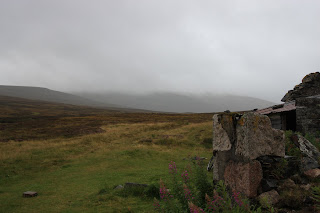
The distance of this hike is actually made much easier by the good tracks in towards this hills from Linn of Dee. Even with my exceptionally slow cycling, it was a distinct advantage to be on two wheels. Although height is gained along the track, for most of the way it's barely noticeable, and I only realised it for the most part on the return route, when progress was clearly faster. The exception is after the west turn 2km after White Bridge, where, besides an abandoned bothy, the track does start to twist its way upwards slightly, although never so much that I got off the bike.
The going was still tiring as it was much windier than and I anticipated. It was also at this point that the deluge came on, getting my legs soaked as I wasn't quick enough making my decision to get the waterproof trousers on. Starting to get cold then, I walked across a deep ford with the bike (slimy rocks!), and then dumped my bike before the Geldie Burn, for another stride across, this time through a shallow but fast flow. Some hikers here on the other side tried to encourage me to cycle across, as they said it was fine as long as I kept my balance. True enough, but the water was so dark, you couldn't see any obstructions through it, and if I went in so did my SLR camera and a few other gadgets. The main thing that put me off their advice though is that they were sat on the far bank changing their socks as they said this! Hmm.
At Geldie Lodge I had some snacks and discovered my platypus had leaked despite my thorough checking of it in the morning, probably it was as a result of over-filling and then being squashed in the bag. There was still half in there, but it was annoying, especially as I usually took spare water but hadn't today to save on weight. I still had my flask of hot drink so there wasn't too much of an issue, but unlike with other rivers, the colour of Geldie Burn made me guess it wasn't going to be a good back up plan!
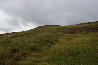
Finally hiking instead of biking, a good path meanders on from Geldie Lodge toward the actual hills, not that I could see them with the low cloud that had accompanied the rain. After a fair while, the glen of Allt a' Chaorainn is entered, but cruelly here the path heads downstream, away from the targets, and it is left for you either to cross peak hags onward to the slopes of Carn an Fhidhleir or go a similarly random route up the glen. I chose the former, which was much better than I thought it would be, especially as the sun chose this moment to come out again, and the cloud moved on from both hills.
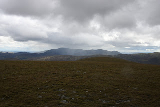
The climb up was surprisingly quick and the crest of Carn an Fhidhleir gave good, albeit windy, walking, with grand views over the cairngorm plateau and to Beinn a' Ghlo and Glen Tilt to the south.
After that a good although thin path continues forward up the glen, but then dissipates in the final stages down to the boggy col before An Sgarsoch. Here, thin trails lead anywhere as long as it's up, and the summit of An Sgarsoch is quickly reached. At this point for me, the weather turned wet again, and I quickly moved on, down the NNW ridge over tiring heather and bog until finally the Geldie path was met again, where I rewarded myself with some snacks.
Back at the ruin of Geldie Lodge, I made use of the convenient shed structure attached to one side for some more nutrition and a re-ordering of my pack ready for the cycling stage. Accepting getting wet with the rising Burn, I just strode through it, and enjoyed a rapid cycle back to the car, finishing in clear weather, making the whole experience end on a fantastic high.
Other hikers!
Labels: An Sgarsoch, Carn an Fhidhleir, Carn Ealar, hiking, munro, Tarf, Tarf and Tilt Hills


2 Comments:
Hello George, great to read your latest post. This sounds rather hairy in parts (but not for you) especially where you discover you have less water than thought due to leakage! Then later your snacking in the shed so to speak. Wow, breathtaking and desolately beautiful pics too. Stunning post, both to read and see!
Saw some gorgeous family pics of Xavier recently, he is a real cutie isn't he, so sweet. Congrats and best wishes to all.
Cheers Chrissie, it was quite a day out that's for sure!
Thanks wrt Xavier as well, I'm seeing him tomorrow for the first time in 3 weeks!! Looking forward to it. He did his first full roll today so I'm very excited!!
Post a Comment
<< Home