Munros, munros, munros as far as the eye can see! An active journal of this active pursuit, but do there have to be so many? Advice, stories, photographs as well as a good variety of completely off-route rambles.
Sunday, May 04, 2008
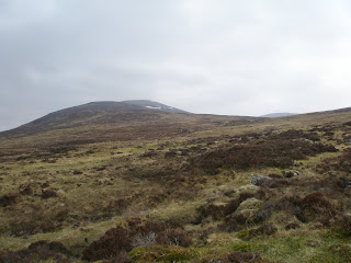
Laggan and the Monadh Liath: Geal charn (260)
Walk date: 04/05/08 My Munro #'s: 143
Pronunciations - translations - heights: Gyalkaarn - white hill - 926m
Statistics: Duration - 11:00 - 15:00 Distance - 12.8 km Total ascent - 868m Weather - Cloudy but warm. A southern wind meant that even with the buffeting we experienced at altitude this was a warm day's hike. Some light rain came and went a couple of times and the summit was in cloud, but for long stretches of the descent we had some beautiful light on the hills. Team - with Sonia. Other hikers: about 10.
After seeing many a good weekend pass by without any hiking content, it was great to get some extra work I'd been doing finished and free up my free time again for some hill action. The target was a simple single hill with 'only' 2.5 hours driving each way, which would see me have visited all of the Munros in the Laggan and MonadhLiath region.
After passing Laggan, the road gets thinner and thinner until eventually you have to open and close a gate at Garva Bridge to allow your progress to the best 'car park'. From there a farm lane is followed over another bridge with a raging torrent under it and the left fork taken at the trees. Here though it is tempting to carry on along the nice farm track but a look at the map reveals this veers off route quickly, and the path such as it is wetly follows the river up until the AlltCoire nan Dearcagtributory is met.
Rather than meet it and follow it up, we cut off the corner and then took one of the many opportunities to cross over later on. However, higher up we found a path that follows the south western back of Gealcharn and it could be that this also exists lower down and offers good progress. In any case, the ascent offers no real challenges and is easily achieved whether you're following the path or free-styling it. The only trouble with the hill is the distance to the summit once the incline levels off; it is much further than you would imagine if, like for us, the cloud drops down. In such conditions careful navigation is required especially as the actual summit is barely higher than the surrounding terrain. Thankfully, the cairn is huge and you definitely know when you've reached it!
Our return differed slightly in that we followed the path down the south western back as far as the rocky outcrops visible on the map and then, in order to avoid the wet lower ground, kept to a steady contour until the forest under Meall an Domhnaich. This was a very pleasant descent but a word of warning should accompany it as we later discovered a tick on Sonia and I reckon it was picked up while crossing the rough heather here. See the new tick links for important information with respect to removing them and looking out for symptoms of the serious conditions you can develop as a result. Ticks are most common April-October but can occur outside these dates so please be careful.
Despite the biting, it was a great day out. It felt so great to be on the hills again. Our day wasn't over however, as we had a date with the Cadenhead's Whisky Shop tasting event as part of the Speyside Festival in Dufftown on the return. Turning up exactly on time, the kindly Sonia had to sit through 30 whisky obsessives including me being taken expertly through five tastings from the Cadenhead's independent bottling range. These were Allt-A-Bhainne (Speyside, 14yrs, 56.2%, £43, my score 8/10), Imperial (Speyside, 29yrs, 54.7%, £106.5, my score 7/10), Auchentoshan (Lowland, 17yrs, 59.2%, £47.7, my score 6/10), Ben Nevis (Highland, 16yrs, 46%, £37.3, my score 5/10) and Ardbeg (Islay, 14yrs, 46%, £36.3, my score 11/10). It was fantastic and I have a feeling that this won't be my last festival attendance!
The rest of the Laggan range keeping its snow:
Making a start, target in the centre:
Great views back down the valley:
A lot of heather to cross as we start to climb:
Great views to the north-west:
Sonia and I pull away from the pack:
The cloud coming in:
Lunch over, let's get to the whisky!
That south-western back complete with path!
Coire Gorm (NW) looking wild:
Looking back up Geal charn:
That wild tick-land:
Whisky-tasting!
Is this my demographic? Will this be my gut in 10 years?
Laggan and the Monadh Liath: Beinn a' Chaorainn (80) and Beinn Teallach (282)
Walk date: 16/02/08 My Munro #'s: 141 and 142
Pronunciations - translations - heights: Byn a choerin - hill of the rowan - 1049m byn tyellach - forge hill - 915m
Statistics: Duration - 11:15 - 16:00 Distance - 17 km Total ascent - 1215m Weather - Cold. Despite some sun breaking through early on in the day the cloud at about 700m stayed firm and increased in the afternoon. Light winds at height increased the chill but generally a pleasant day for this time of year. Team - solo. Other hikers: a half dozen through the day.
Hurray! It’s walking time again! Yes, the first hike of the season saw me undertaking the three hour drive to Laggan again this Saturday, but it was totally worth; such a great feeling to get to the hills again, and it certainly helped that these were darn good hills at that.
After an initial stop at the wrong carpark, only identified with help from the GPS, I found the correct start and set off up a steep forest track from the tiny hamlet of Roughburn. Once at the fork in the path the incline leveled but this was just a brief respite before the massive relentless grassy shoulder of first target Beinn a’ Chaorainn. This route avoided the steeper start of going straight for Meall Clachaig, which I saw people on, but that route would have then had the advantage of a flat section to catch your breath on. The choice is yours.
The view from the carpark, 3 hours to Aberdeen that way:
The start of the climb to Beinn a' Chaorainn, get stuck in!
Looking across the loch to the impressive Ben Alder group:
And again:
And then some:
Anyway, after some time plodding breathlessly on and cursing my lack of fitness after an activity-lite winter, this pathless assault did finally peter out to leave me on the wide but abuptly-sided summit ridge of Beinn a’ Chaorainn. Unfortunately, the summits were in total cloud on this day so none of the surely amazing views up Loch Laggan and across to Creag Meagaidh were to be had. The summit here is the middle of three tops so don’t be fooled by the solid cairn on the first top (I saw four hikers here having their lunch stop here, and I wondered later on if they realised that they weren’t quite there).
The entire ridge of Beinn a’ Chaorainn is a pleasant stroll, all the better for the wind being relatively calm. The descent to the north west toward Tom Mor is one of your usual grassy slope affairs, albeit on this day complicated by frozen ground and wide snow sheets to cross. In fact this northern side was perhaps predictably a much colder affair, confirmed by the desolate features of Beinn Teallach and the impressive isolation of Loch Sguadaig and its surrounds coming into view as I dropped beneath the cloud.
Finally, the first top of Beinn a' Chaorainn:
Spot the difference, the actual summit of Beinn a' Chaorainn:
Stay off the snow, it's a long way down!
On the descent, dry ground runs out!
Any way you look at it you're going to have to cross it:
Phew, down safe:
I aimed for the start of the north ridge of Beinn Teallach rather than start up the steeper slopes to try and take a short cut onto it. I was glad of this as even this gentler approach was hard going due to extensive coverings of hard-packed snow-ice. I took a lot of care and time over these, stepping in frozen footsteps from previous hikers when they were available. Eventually with patience the summit came into view (given the low visibility only when I was right on top of it!). A quick drink of ice-cold water and I carried on over much gentler terrain and even, for a while, a path! Before long the progress became quite rapid as the southern side was almost completely free of snow. I dropped below the cloud as well and with soft ground again, some of that good fun downhill jogging was possible.
Loch Sguadaig and the north ridge of Beinn Teallach:
Looking down the glen toward Loch Laggan:
Cold ground on Beinn Teallach's north side:
Good spot for a picnic anyone?
Slow progress over the ice:
Some welcomed features in the winterland:
Beinn Teallach summit:
Ice on the 'warmer' southern side of Beinn Teallach:
Before long I was on the path that gently rises up the glen. A ‘can’t be bothered trying to stay dry’ crossing of Allt a’ Chaorainn then took me back into the forest from where I’d started and to the car. A great return to the hills with some exhilarating conditions. Excellent!
Loch Trieg just visible to the south:
The Ben Alder group again:
Back to Beinn Teallach (L) and Beinn a' Chaorainn (R):
Laggan and the Monadh Liath: A' Chailleach (251), Carn Sgulain (271) and Carn Dearg (225)
Walk date: 22/10/07 My Munro #'s: 136, 137 and 138
Pronunciations - translations - heights: A kaalyach - red hill - 930m Kaarnskoolin - the old woman - 920m Kaarnjerrack - hill of the basket or of the old man - 945m
Statistics: Duration - 09:15 - 16:55 Distance - 24.5 km Total ascent - 838m Weather - Still, but overcast in morning. Cloud came in on CarnSgulain and stayed almost to CarnDearg with strong cold wind and some rain. Came fine during descent. Team - with Steve W. Other hikers: none
A long route round, but a nice short-cut at the end:
Well, my book had certainly got this weekend's two walks the wrong way round! Yesterday's was supposed to take at least 8 hours and today's as low as 6, but the only way this latter could happen is with a pair of trainers and a lot most fitness than me and my compadré Steve W had, especially given the liberal wine and whisky at the big meal on the Saturday night! That being the case, we only set off today a little after 9am; no pre-dawn hiking today.
No matter though, the carpark was much nearer to Newtonmore and good progress was soon being made up a good wide track. A small cairn marks a subtle departure from this track leading to a crossing of Allt a' Chaorainn. It's here that the bog for which these hills are well known first becomes evident. It did impede our progress today, even given how dry it had been lately. Definitely one to avoid if it's been wet.
After the crossing, the path can become indistinct, but keep on a heading through the shielings and then past the "bothy" which in reality is a rusty shed with a table in it and not a welcoming place to spend the night! All this takes you to the main plateau and then a brief further climb of 150m or so to the summit cairn of A' Chailleach is all that's required. We heard many a randy deer on this section, but fortunately weren't challenged!
Autumn just seems to suit Munros:
A quick geology lesson from Steve, some folding rock:
Fixer-upper? That impressive bothy:
The summit of A' Chailleach:
A good corrie is found on A' Chailleach's eastern edge:
After A' Chailleach, a good path starts off north toward CarnSgulain but soon runs out. We then dipped north-west to more gentle slopes and made a free-style route over some wide bog and onto the broad rocky back of the Munro. Interestingly we headed for the second cairn and lunched there as it appeared the uppermost, but my map places the first cairn as the higher! It's academic as we had a good stomp over both.
The 'second cairn' of CarnSgulain:
It was whilst sat on CarnSgulain that the thickening clouds finally dropped down and with then came some cold wind and light but stinging rain. In very low visibility then we pressed on along the path that religiously follows the fence-line marked on the map. The walking was mostly good and fast but included in each dip was a wide and challenging bog (and remember this was the dry version!). At one point a gallant attempt by myself lead me to having one leg stuck up to the knee, it taking me three attempts to pull clear!
There had been a rough plan to meet our friend Dennis on the one-time Munro CarnBallach, however after waiting 15 minutes to no avail (and with very good visibility at that point), we pressed onward to CarnDearg, by far the best hill of the day. Dennis, it later turned out, had turned back expecting no views due to the enclosing weather).
CarnDearg was a welcomed relief after the day's walking thus far. Not only was the weather improving, but CarnDearg is no gentle mound. Instead sharp characterful crags curve high over GleannBallach giving wonderful views and a satisfying summit to take in. This would be the only one of these three hills I would be up for repeating.
CarnDearg from CarnBallach:
Just simply superb views over GleannBalloch:
The only issue regarding CarnDearg is getting off it. The lower slopes and GleannLochain having no distinct route as such, although I feel we did very well on this day and would recommend our track (in red in the map).
Instead of dropping off the western side of CarnMacoul as my book suggested, Steve suggested we head east as it was certainly shorter, and then to our surprise we found a path heading off to the east in the bottom of the rut at CarnMacould's base. This soon runs out, but we headed for a square patch of grass on the opposite side of AlltBallach, treading over RuighGleannBallach. This allowed us to cross the river easily where it was still young.
Then, instead of heading to the farmstead and following the river further, we followed what was initially a very hard to follow path which flanked the base of Glac nan Gamhna. The path firmed-up however, and indeed kept strong after a fence where the map marks it as stopping. This quickly takes you to the abandoned Glenballoch farmstead where a good bridge takes you over AlltFionndrigh and onto an even better path that hands you the carpark on a silver-platter! A good healthy stomp that makes the end of this long day just that little bit better.
"George" is a Yorkshire lad who was dragged up hills all over the country as part of a terrible abused childhood. This has left him with a psychological condition whereby he feels a need to visit innumerable mountain tops, possibly as an attempt to 'cleanse his soul'...