Wednesday, June 28, 2006

Achnashellach and Torridon Hills: Sgurr Choinnich (139) and Sgurr a Chaorachain (78) BUT NOT Maoile Lunndaidh (125)

Walk date: 02/05/06
My Munro #'s: 73 and 74

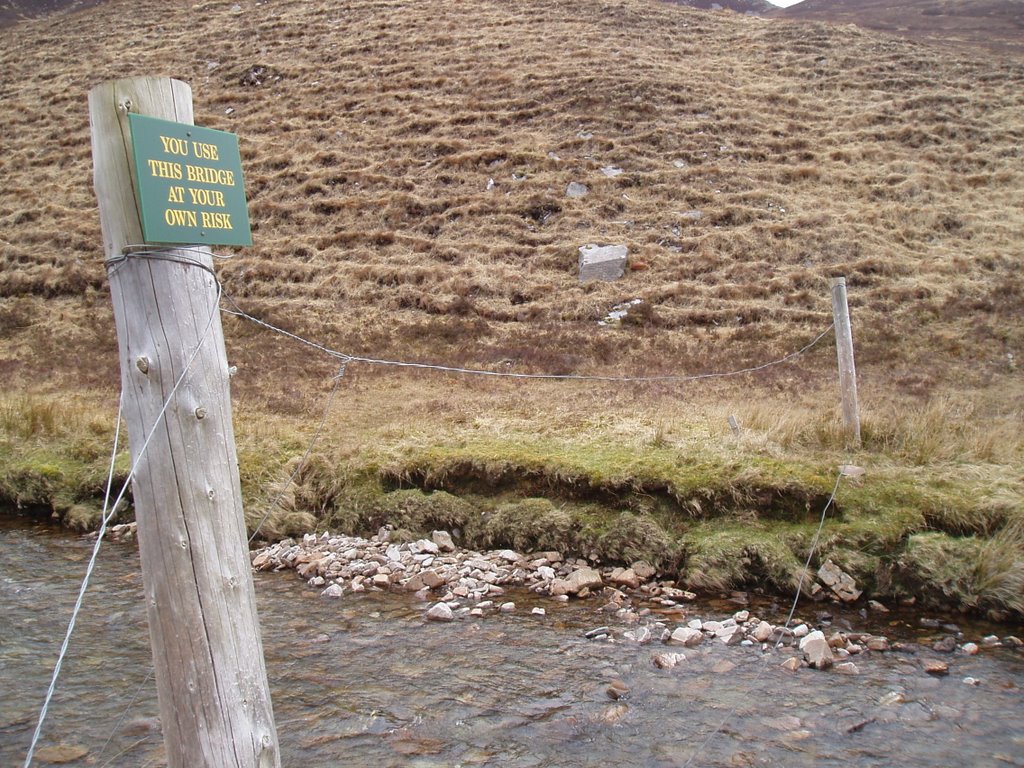
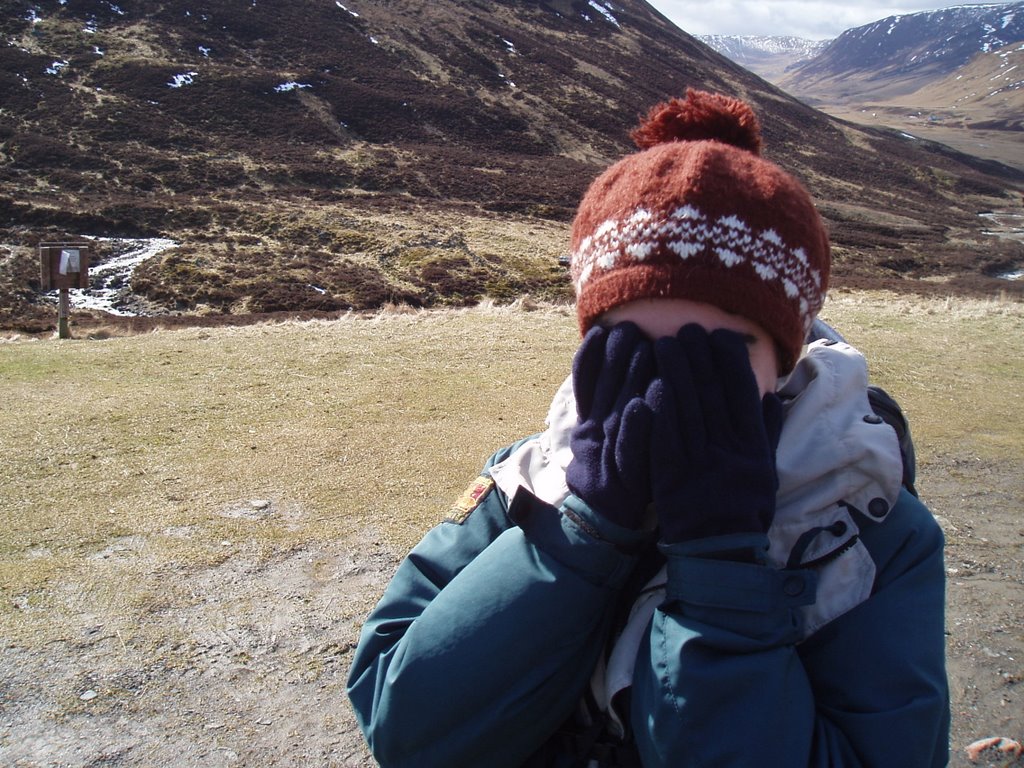
Interesting use of the word 'bridge':


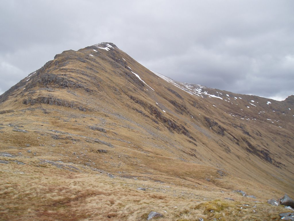
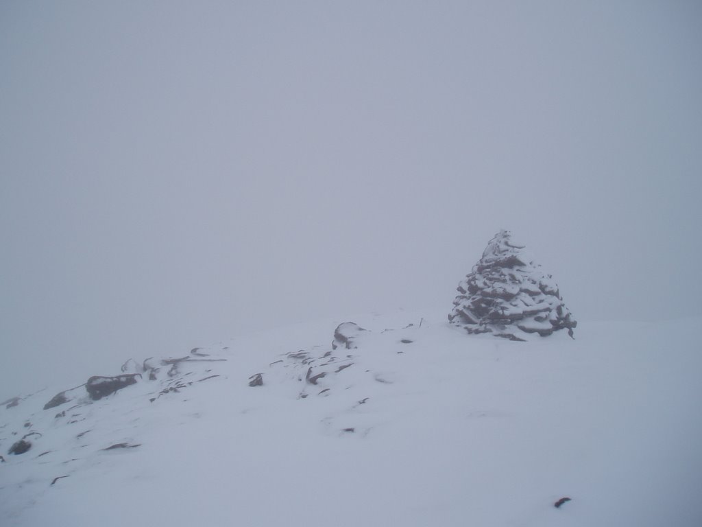
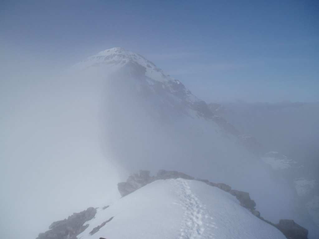
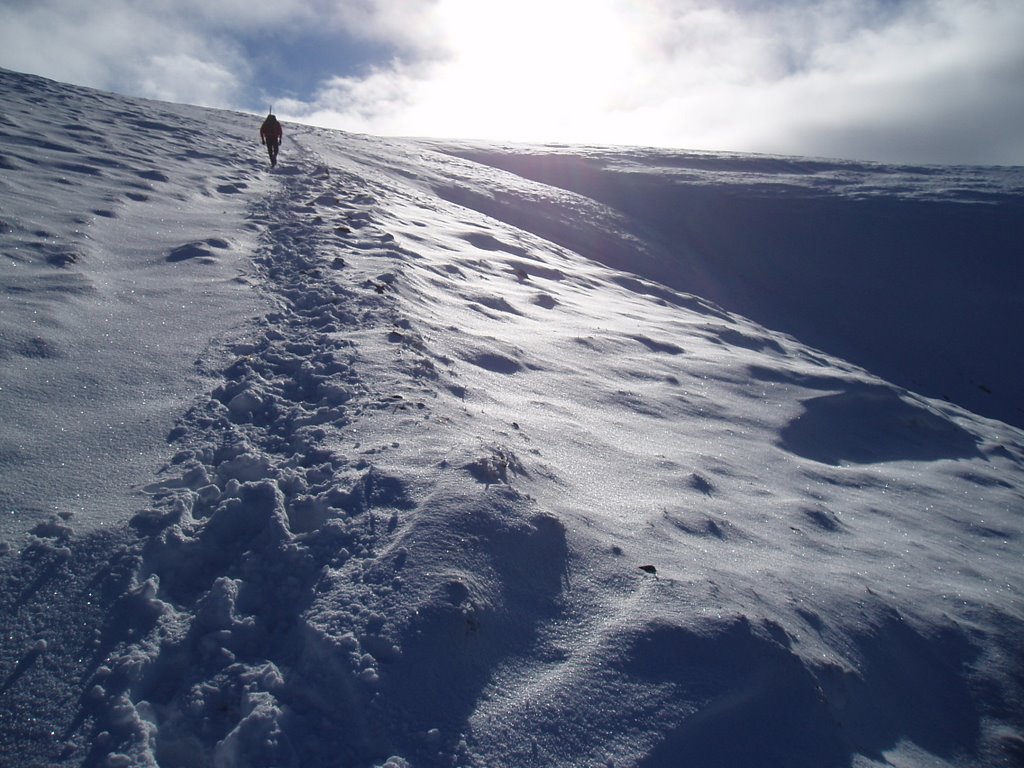
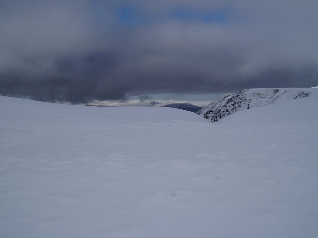
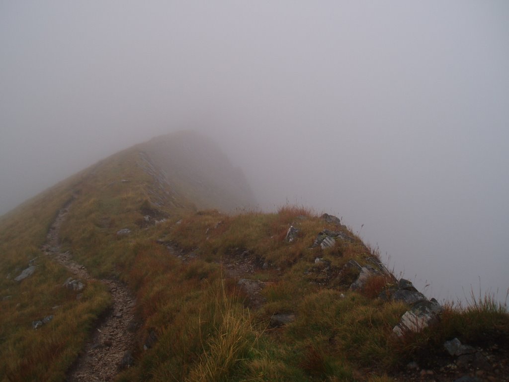
The west ridge of Sgurr Choinnich offers no shelter:


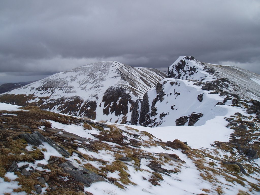
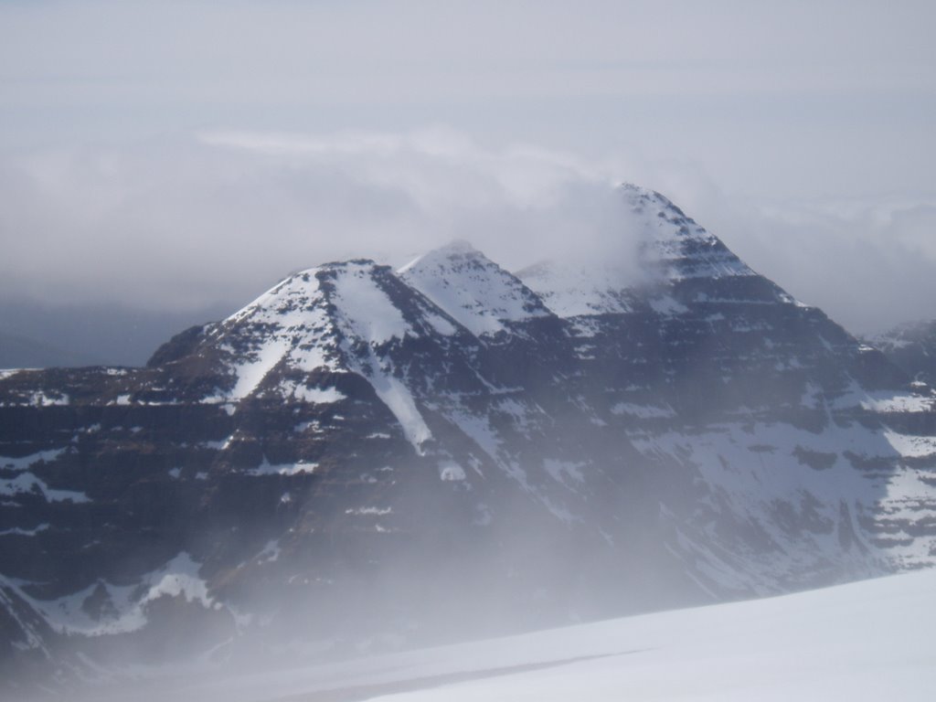
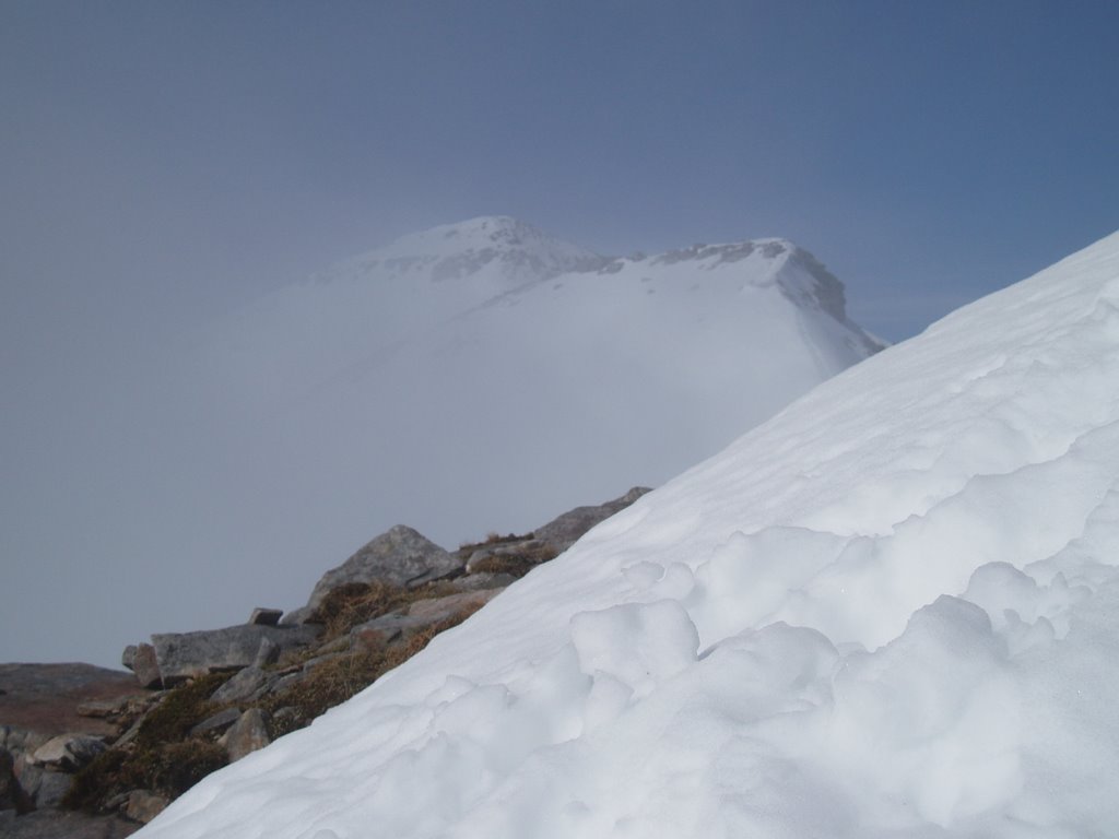
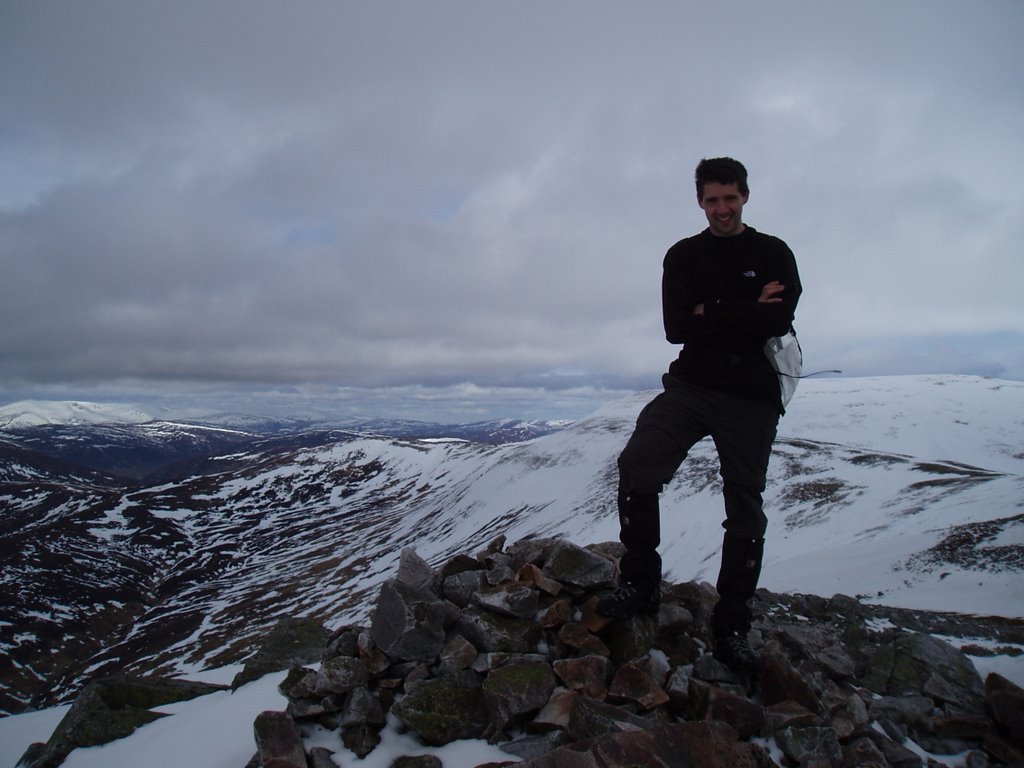
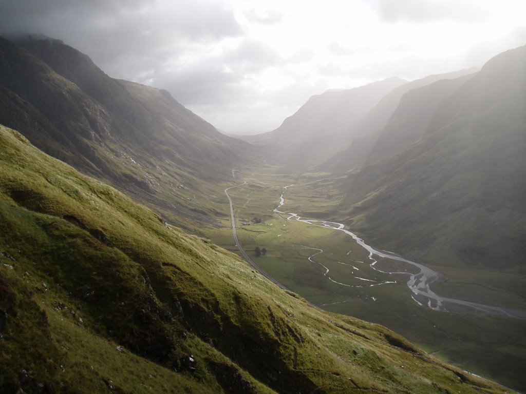
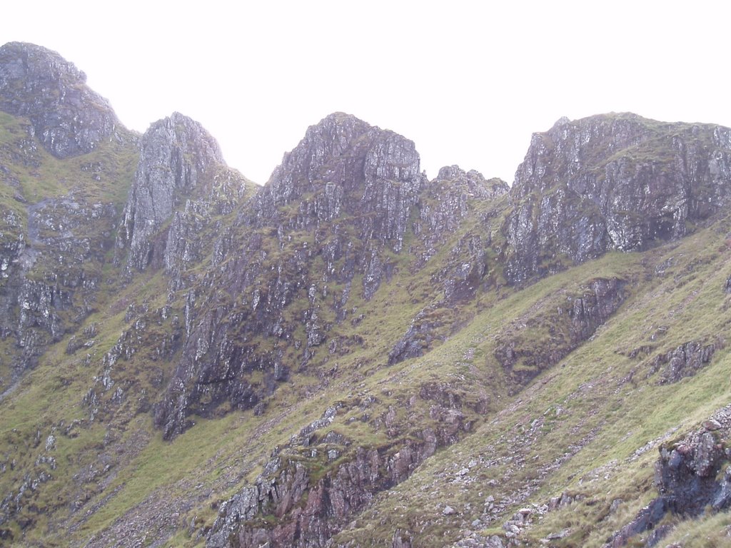
Sgurr Choinnich (right) and Sgurr a Chaorachain (left):


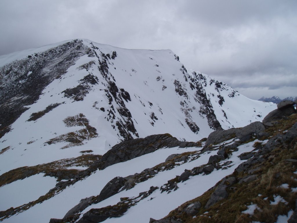
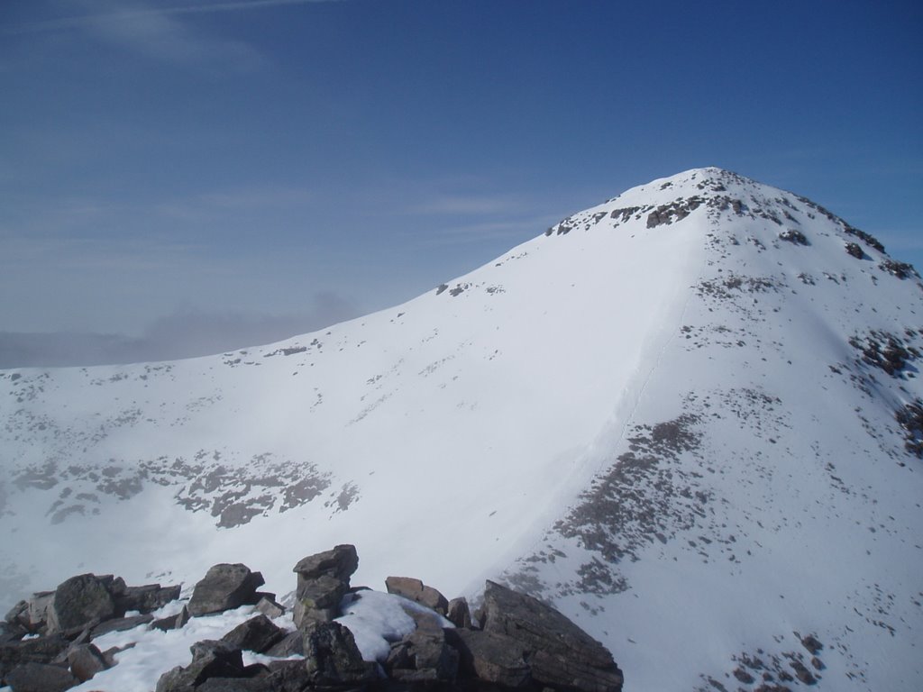
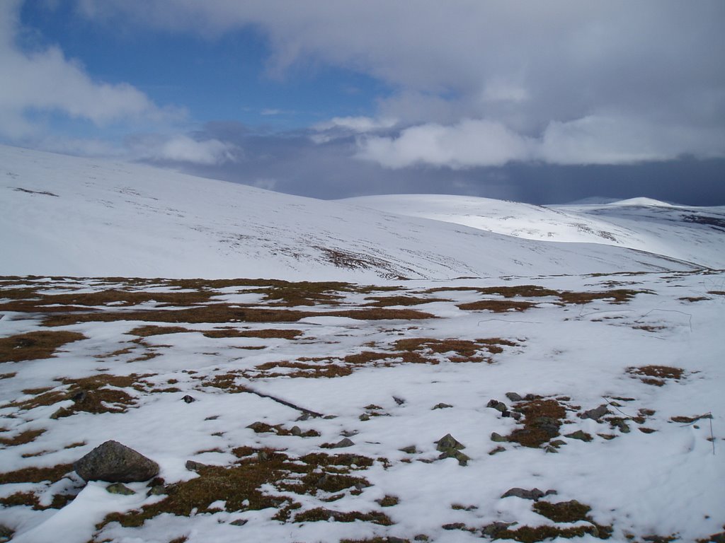
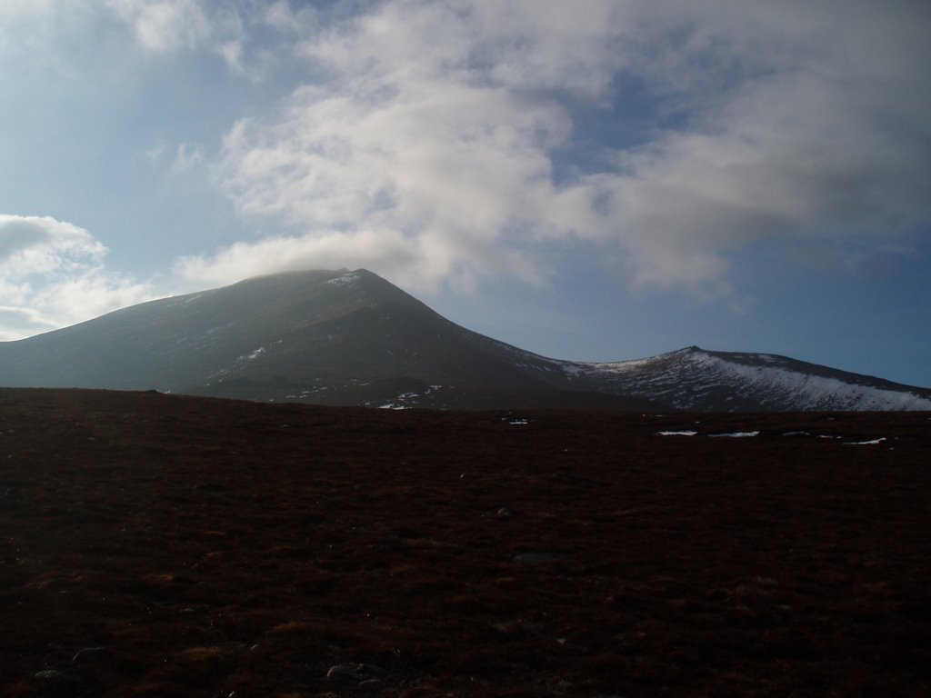
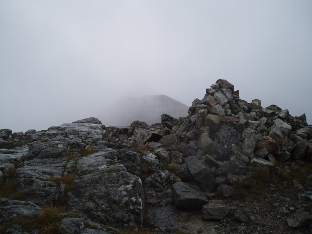
Looking back to Sgurr Choinnich just after the col:


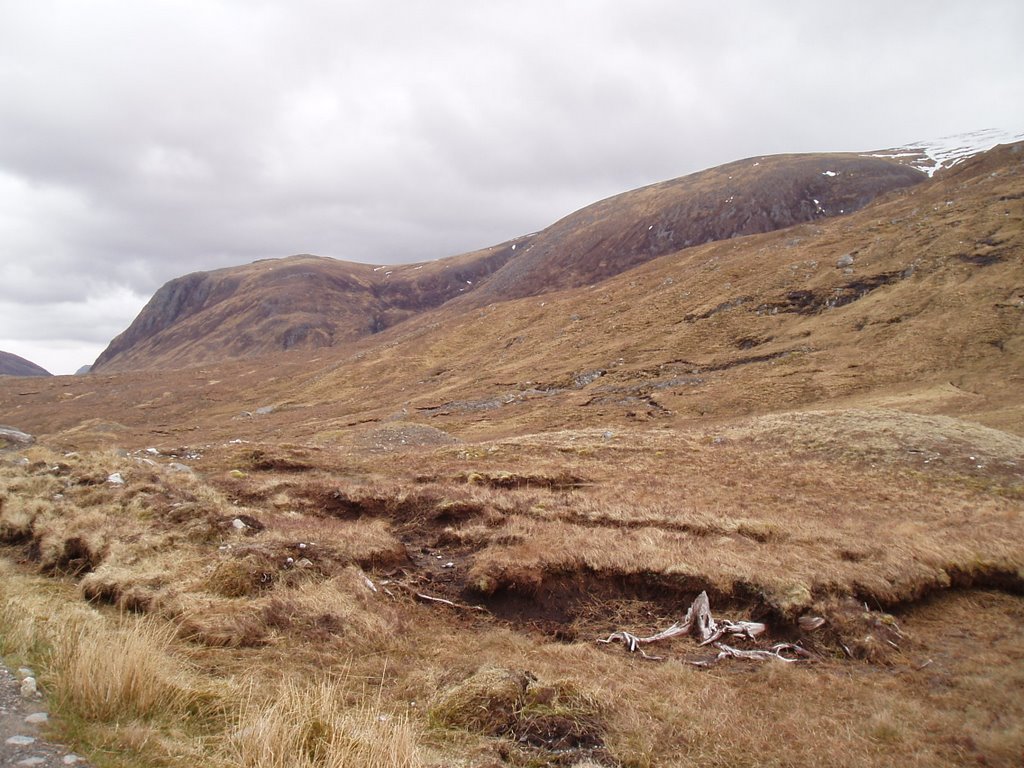
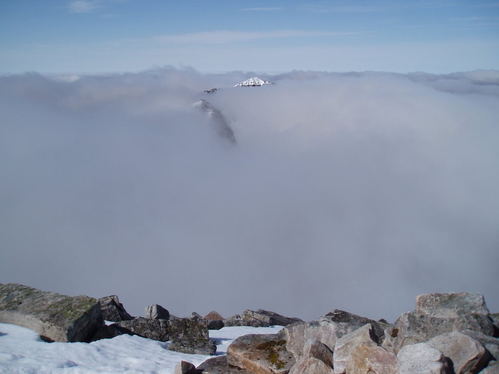
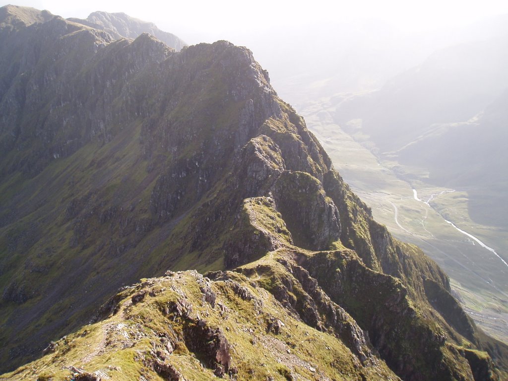
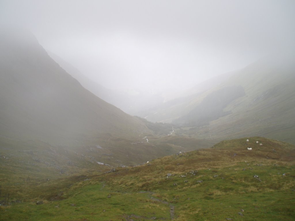
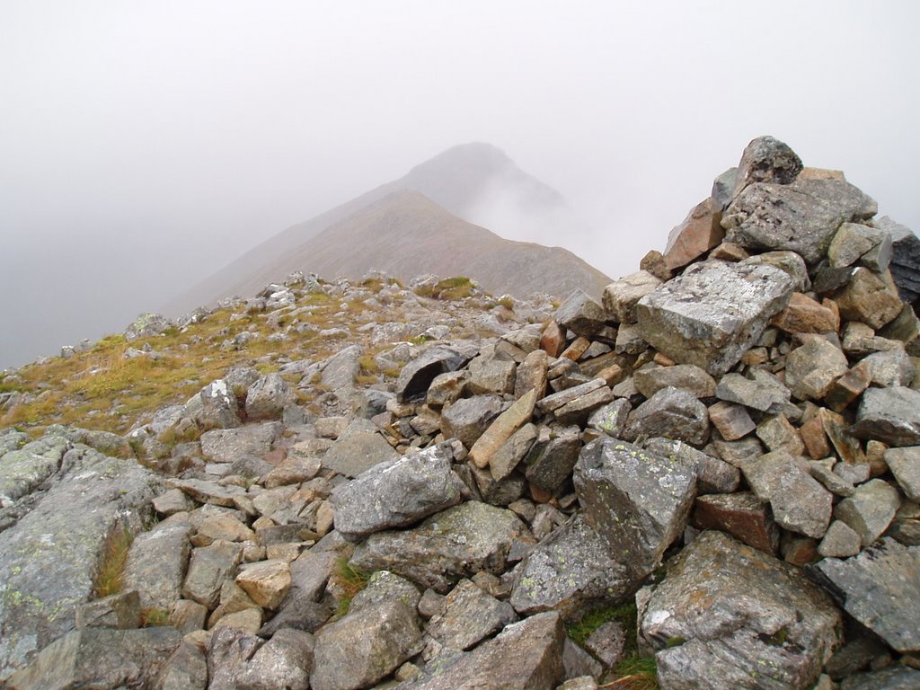
My 'lost' hill, Maoile Lunndaidh:


Hiking Expedition 2006! 09:00-16:30. Knowing that today's walk was one of this expedition's longest, and that severe weather in the form of 60 mph gusty winds and possible white-out conditions was due, I set off in the car with a deep breath and a 'turn back the second you become uninterested' attitude!

The car park at Craig is a forestry car park on the right if coming from Achnasheen, blink and you will miss the entrance. Having put my bike together, I set off across the railway line and onto the forestry track. This started climbing steeply once the river had been crossed and to be honest, with my absence of cycling muscles and 13 year old bike, I pushed it along for most of it!

However, I was still at the bridges over Allt a' Chonais after an hour's effort. Now, when we say bridges, do not be expecting quaint weathered wooden constructions put together by a hard working old hermit. Instead, expect two loosely hung cables, one above the other, and absolutely nothing more. I searched up and down the river for a short while, but decided that the river was just a little too high. Begrudgedly, I started across the second bridge and I must say that it was actually ok once I had got used to the sudden switches from leaning forward to back and back again. This second bridge had its cables closer together and in any case was the better one for the route ahead so check this one out if you're up on this route.

After the bridges, a good path leads up to Bealach Bhrearnais. Although to this point, the odd gust had hit me, there had been no real problems, and gladfully no sign of rain or snow. Of course, as soon as I hit the bealach and started up the exposed west ridge of Sgurr Choinnich I started getting much more weather and my walking started to be impeded. Instead of the path, I started walking south of the crest to minimise what problems being blown over would cause! However, I needed to get to the crest for the summit and I did this by creeping hunched over, for a moment on my knees, to touch the summit stones before retreating and starting eastward again.

This avoidance of the Sgurr Choinnich crest caused a further problem as the ridge to the col before Sgurr a Chaorachain went straight from it, but instead I found myself too far down the slope, tentatively stepping onto a snowbank to try and get a visual of where the ridge began! Finally realising what was necessary, I crept back to the crest and then gracefully sat myself down and pushed myself along with my hands and feet along the snow bank until I got to the rock of the ridge. Once I was onto the ridge, I continued my crest-avoidance and made my way through deep snow and over rock toward the summit of Sgurr a Chaorachain. Going was very slow with the wind increasing and threstening black clouds dispatching from the obvious blizzards on the hills to the south of Loch Monar, but I finally got up to height just below the summit.

Taking in the peak of Sgurr a Chaorachain was still not straight-forward though, as my crest-avoidance had brought me to an omnious snow-bank just south of the summit. From my position below this bank, I could see nothing at all of the route ahead, even at full stretch. Although by my own and by the GPS's reckoning, it was but a brief step north to the summit, the wind was so strong that stepping over the bank would most likely mean falling over, and there was no visual confirmation to stay that no, of course there wasn't a sheer drop immediately ahead. It most likely took me only five minutes to build up the courage to trust the navigation but it felt like fifteen! Suddenly, I moved onto the top of the bank in a crwal and literally on all fours, made my way onward, no doubt looking very sexy! Almost immediately, I thankfully saw the summit stone ring and, tapping it quickly, transferred back to merely hunched walking, and picked up speed down the slopes to the north.

Very quickly onto the sheltered side of the hill the effect of the wind was much reduced and I started exhaling waves of relief. Having decided somewhere between the two hills to ditch the third, Maoile Lunnaidh, I made my way down to the forestry path again. Sitting having a second lunch, I started to seriously contemplating taking in Maoile Lunnaidh after all, just ascending it from that sheletered side and indeed I even walked for fifteen minutes along the forestry path toward it. Wisely though, it being 15:15 already, and with my feet throbbing as the full size of it came into view, sense prevailed and I reversed my route.

Once the bike was picked up, progress was rapid, especially as I discovered that my rear brakes weren't working and squeezed my front ones so much that the air was particularly sulphurous.
My drive back went through Locharron where I was able to replace the waterproof trousers that my bike had just chewed through! Blustery day out with no too much regret over the 'lost' hill.

Labels: , , , , , , ,

Friday, June 23, 2006

Achnashellach and Torridon Hills - Beinn Alligin: Tom na Guagaich (268) and Sgurr Mhor

Walk date: 01/05/06
My Munro #'s: 71 and 72

Tom na Guagaich looking chilly:


The ridge north off Tom na Guagaich:


The impressive Eag Dubh na Eigheachd:


At last, Sgurr Mhor. Time to go home!


Yours truly, taking in the Scottish Spring:


Hiking Expedition 2006! 08:30-14:30. The 'Horns of Alligin' are enthused about in many a guidebook. However, still suffering from my Aonach Eagach hangover, I didn't want to commit to them straight-off. To this end then, instead of the circular route recommended by my guidebook in a counter-clockwise direction, I decided to flip it round, thus making the Horns an optional extra with re-tracing my steps from Sgurr Mhor being the main idea. As it turned out, the snow that came down on this day, put any notion of the Horns far from my mind, even threatening the attempt on Sgurr Mhor!

From the carpark, immediately next to the bridge on the road I headed LEFT of the river to the start of the path toward Tom na Gruagaich. The going was steady on a decent path, but one unfortunately blighted in sections by boggy ground; this day was very wet and the low cloud completely hid the hill somewhere ahead. From the lower ground, a steep stile soon led to a greater incline and the lack of view made the word of a woman from the hostel, 'You're going west to east? That's so steep!', magnify in their power of foreboding! In actual fact, it was nothing particularly bad, just an honest direct approach on a Munro hill. By 500m, all the rain around had become snow and the ground started to get rather white, obscuring the path. Not that there was much choice; the channel of Coir nan Laogh has sheer sides!

Guidebooks talk about the sudden revealing of the view from Tom na Guagaich and I can imagine this is the case as the hill blocks all views until the trig point is reached when the ground immediately falls away. However, on this day, all that could be seen was white in all directions!

After the steep incline up to Tom na Guagaich, the second part I was really worried about had to be tackled. This was the ridge that drops down from this hill to the north and the way ahead. From the map, this looked incredibly narrow and fairly steep. No matter though, as even in the fresh snow it was at worst some enjoyable scrambling and mostly a straightforward path, I just made sure I took one step at a time.

In bad visibilty watch out for the cairn at 862m, as wishful thinking can make you imagine its Sgurr Mhor. Sgurr Mhor itself is soon reached however, that is after the impressive Eag Dubh na Eigheachd gash and a quick left at the end of the climb. Here is the point from which you can progress over the Horns, but like I said, not for me in conditions such as this day's. If they are for you, then nice one, and enjoy! Me, it was back along the same route. No problems encoutered.

Labels: , , , , , , ,

Thursday, June 22, 2006

Achnashellach and Torridon Hills - Beinn Eighe: Ruadh-stac Mor (120) and Spidean Coire nan Clach (150)

Walk date: 30/04/06
My Munro #'s: 69 and 70

Looking down the corrie over Loch Coire Mhic Fherchair:


The extremely sheer drops of Coinneach Mhor:


Coming up on Ruadh-stac Mor:


Great views of Liathach from Coinneach Mhor:


Approaching Spidean Coire nan Clach:


Hiking Expedition 2006! 08:30-15:00. From the car park at 957568, the good and obvious path rises gently as it rounds Stuc a' Choire Dhuibh Bhig at the eastern end of Liathach and is then flat and simple all the way into the corrie of Loch Coire Mhic Fherchair, which actually takes a surprisingly long time to get to.

The corrie itself is really is impressive as the guidebooks make out, with crystal clear water revealing rocky and algae-clad sections of the loch-bed, coupled with the three mighty buttresses of Sail Mhor. From the corrie, the first target, Ruadh-stac Mor, can be seen clearly provided there's no cloud in the way. My original plan for an ascent had been to climb the grass and rock slopes to hit the hill's spine north of its col with Coinneach Mhor, however the snow that remained in the short gully to the col revealed footprints, and these tempted me to take that route. Unfortunately, the snow on this section was much harder and icier than I had expected, especially given the soft snow the day before on Liathach. To add to it, the dry sections were made up of the loosest type of scree. Progress was all-round slow. About half-way up, some easy-looking scrambling routes over the rising rock sides became apparent, and I decided to give them a go. Soon however, the scrambling increased in incline and started to get worryingly near the foreboding sheer drops on the eastern end of Coinneach Mhor's north wall. Some retraced steps got me next to the snow channel again, but thankfully higher up than I'd left it! From here, a short horizontal version of the previous day's kicking and punching efforts got me to the footsteps again, which at the higher altitude were solid enough to not give way, and so could act as a useful staircase! Once on top, Ruadh-stac Mor was easily reached and I spent the way wondering how the grassy slopes would have worked out.

From the summit, the col was soon revisited and a stiff but short climb got me onto Coinneach Mhor. From that point on the route was easy with no real danger as long as you keep away from the edge! A good climb gets you onto the trig point, but look at the map closely as the actual summit of 933m is a short distance NNE with the link involving some light scrambling (although it could prove heavier with ice!).

Returning to the trig point, a quick southward stretch gets you to the cairn that marks the start of the easterly drop down along side Coire an Laoigh. On this day the slopes were heavily snow-laden which made things interesting though manageable. The rest of the route back is a simple path followed by the inevitable road walk, but it comes with excellent views of Liathach!

Labels: , , , , , , ,

Tuesday, June 20, 2006

Achnashellach and Torridon Hills - Liathach: Spidean a' Choire Leith (75) and Mullach an Rathain (108)

Walk date: 29/04/06
My Munro #'s: 67 and 68

Hiking Expedition 2006! This walk was actually two separate walks. After all the reading I had done re: the ridge between these Munros and how 'wonderful' and 'challenging' it was and given my Aonach Eagach experiences, I decided to avoid it like the plague and take in each peak as separate ascents. This turned out to be an even better decision when I got up to height and found a rather large amount of snow sitting proud.

Walk 1 - Spidean a' Choire Leith:

First sign of the target, just one top to go first:


Some of that sexy cloud inversion:


Just a tricky descent to the col & then it's home-dry:


In all its glory, Spidean a' Choire Leith:


On the summit, complete with Amplifico T-shirt:


Just the small matter of getting all the way back now:


Without a doubt, this hike has easily become my favourite ever outing. Such an amazing, challenging and triumpthant experience!

Having decided not to attempt the ridge, I indeed did take these two Munros in in one day. However, this is not to say that these hills can be rushed; Spidean a' Choire Leith especially requires respect. Anyway, I started at the recommended car park just east of Glen Cottage (934567, bascially this car park is an oversized passing area). The path starts rocky and is in good condition, soon rising quickly but not giving much challenge except for the odd required hand-usage. From Coire Liath Mhor the path becomes steeper with a little more scree but remains obvious all the way onto the ridge. Don't worry about guide books trying to describe which gully to ascend as in decent conditions at least, there are no navigation troubles.

Once onto the ridge, I was greeted with a lot of snow along the crest. Morning cloud was still present blocking views, however the shape of Stob a' Choire Liath Mhor could soon be seen through the mist and did elicit a 'oh, fuck!'. From this point on, most of the thin ridge consisted of very careful stepping into existing prints along the thick snow-cap of the ridge crest. Soon the rising heat started revealing peaks by cloud inversion, an absolutely awesome sight that brought out several more expletives and a brief moment of leg-shake. The first sight of the destination peak pushed things even further and prompted a 'Jesus!', the thin ridge rising to the summit with a thin train-track of footsteps on its narrow crest. For a while over Stob a' Choire Liath Mhor I trained myself to only watch my feet so as to not lose my nerve, as the actual footwork even on the snow so far required concentration but was actually ok.

The worst point on the traverse came next, however, as the descent to the col before the Munro ascent was the only point that got me worrying. This consisted of the steepest snow section of the day. Although it only lasted about 5 metres I took quite a while on it, turning to face inward for the end section as I kicked foot-holds and punched hand-holds into the slope. Water-proof gloves would have helped a lot! It should be noted that this section would have been no trouble with an ice-axe and crampons, my own unequipped fault!

From the col the route was initially thin but but nothing worse than what had passed; I was used to it but more importantly I was on a high from knowing that I was going to make it, that the Munro was in the bag! Standing on the summit felt like such a privalege and was an absolutely wonderful experience. The views were spectacular with cloud inversion turning into clear views in selected directions. It really was awesome, and a well-deserved tick in the book! The route back gave no trouble with the tricky section proving an easy ascent and the path off the ridge allowing a nice trot down. A very memorable Munro.


Walk 2 - Mullach an Rathain:

Overhang on Mullach an Rathain, tread carefully!


The not-recommended north side of 'Rathain:


The Liathach ridge, not attempted by I:


Parking back at the Youth Hostel and having had my lunch, I set off along the road for Liathach's second Munro. The start of the path is marked by a small cairn between the two patches of tress where the road is nearest the river. The way is initially quite flat with bog, but also short, fun rocky sections. Don't pick too random a route at this stage as a stile in the upcoming fence must be met at 914557.

Beyond this point the incline increases and remains steady until around Toll Ban when the still obvious path starts climbing scree slopes towards the summit. The scree is nothing much to worry about being more annoying than dangerous. The view from the immediate summit is another grand reward especially looking east towards Spidean a' Choire Leith and the infamous ridge. I would have liked to have gone and had an investigative look, but being a little fatigued by this time, it was the return route that I opted for. A nice hill but much easier and simpler than its neighbour.

Labels: , , , , , , ,

Glenshee and Lochnagar Hills: Creag Leacach (159) and Glas Maol (69)

Walk date: 01/04/06
My Munro #'s: 65 and 66

Out with my exhibitionist walking partner:


Taking in Creag Leacah, bracing!


Coming up on Glas Maol:


Glas Maol decorated with a lone skier:


First hike out with the Sonia. Almost immediately from the car park there is a notably hairy crossing of a narrow but not negligable (especially in winter) stream. The crossing is not helped by a soaking-wet half-collapsed bridge set at a jaunty angle. Once this is conquered the climbing starts in earnest steeply up the heathery slopes of Meall Gorm before heading more gently toward the crest of the ridge that is the summit of Creag Leacach. A wide ridge and civilised incline led to the large domw of Glas Maol. This day's descent was steep down the west side to Meall Odnar and along Leacann Duoh. Sadly, we didn't managed to avoid a repeat crossing of the nasty stream getting to the car. A fine day out with light flurries of snow but mostly dry with broken cloud and beautiful blue skies beyond.

Labels: , , , , ,

Monday, June 19, 2006

The Northern Cairngorms: Mullach Clach a' Bhlair (114) and Sgor Gaoith (36)

Walk date: 18/02/06
My Munro #'s: 63 and 64

Ascending Carn Ban Mor. Just one hiker to beat:


Looking west over Coire Garbhlach:


The impressive Sgor Gaoith with Glen Avon below:


Last of the Cairngorms! This hike started with a nice climb toward Carn Ban Mor, with strong early sunshine and heavy powder snow by 700m. I was soon making fresh footprints after passing to the south of Carn Ban Mor and over a desolate and imposing plain on the way to Mullach Clach a'Bhlair. Going was slow most of the way with nothing to see due to rapidly closing weather. Nothing but white all around at the summit. The return felt much quicker, possibly due to just seeing some other people out there! On my way back to Carn Ban Mor, I re-directed a woman heading south-east instead of west for her descent. She told me she thought she was ok because she was going down. Hmm. As I had made my way to this point, I had developed an odd ankle pain, probably due to all the twisting in the heavy snow. As time was fine, I decided to press on to Sgor Gaoith, which turned out to be a much different and impressive peak. A few merciful breaks in the cloud allowed for some amazing views at this point. Well worth the extra effort. Took the descent easy due to ankle.

Labels: , , , ,

The Northern Cairngorms: Bynack More (54)

Walk date: 04/02/06
My Munro #'s: 62

That north ridge looking fine in the morning light:


East from the plateau:


South-west from the summit into the Cairngorm massif:


I became nervous about this week the night before as the TV kept giving out 'treacherous conditions' warnings; despite calm weather it was expected that a cold week would mean that the snow had become hard-packed and unforgiving for grip. However, certainly where I travelled there seemed to have been a thaw! On Dan from work's advice I took my bike along and cycled along good paths almost to Bynack Stables before starting on an easy climb to the plateau. The north ridge looked damn impressive but an easy path meant that the summit was soon reached - at 11am, just two hours out from the car! Having a boost from this speed, I then ran almost all the way back down to the bike, returning to the car by 12:30 in time for lunch! Not a warm day but ok, some moderate wind. Only came across patches of snow and ice. Back in the 'Deen by 15:30 and so forced to drink coffee before it got to beer time!

Labels: , , ,

Sunday, June 18, 2006

The Northern Cairngorms: [Cairngorm (6) and] Beinn Mheadhoin (13)

Walk date: 28/01/06
My Munro #'s: 61

Cairngorm summit:


Beinn Mheadhoin from Cairngorm:


Loch Avon in deep chill mode!


Summit of Beinn Mheadhoin, one of many outcrops!


First fresh Munro since Aonach Eagach! Good but big and EXHAUSTING day out. I knew this would be a challenge given the length of daylight at this time of year so I planned accordingly. My guidebook gave a 6-10 hours for this walk. As I usually am nearer the minimum I gave myself 7 hours to do this even in snow (although with a knowledge that up to 8 was possible). Due to this, I was up at 05:30, with the walk starting just before 09:00 from Aviemore Cairngorm ski centre car park. Took wrong branch out of car park and had to recover by climbing 200m up over a heather-clad slope. Much snow on ground all day long but fortunately no snowfall. Worst weather was on the drive out! From top of slope, route to Cairngorm was fine except that the fenced path to the summit after the cafe was unusable due to solid ice! The descent into Glen Avon via Allt Coire Raibert was challenging due to snow and ice on quite a steep slope. The journey was worth it though when the hidden glen of Glen Avon and its prestine Loch were revealed. The ascent of Beinn Mheadhoin was fine but time pressure meant that it was a push and that the short boulder field was a rather unwelcomed sight! In total cloud and snow, a lack of concentration at one point took me close to an overhang too! Anyway, on top the walking was good, but this hill has many false tops and I was very glad of the GPS simply so I didn't have to spend valuable time making sure I had really made it! Especially as I finally reached the summit past my 'official' half-way point timewise. Due to time, I decided to retrace my steps for the return rather than follow a recommended but unroute route that my guide-book had suggested going around the east side of Loch Avon before heading back to Cairngorm. The climb back to Cairngorm was very exhausting but I had to keep up the pace. I went west of the summit to save some ascent but I've since thought that the summit might have been better than the drifts and ice that I encountered instead. Thankfully I had a quick and easy descent down, getting back to the car at 16:10 with pitch-darkness at 17:00!

Labels: , , , ,

Thursday, June 15, 2006

Glencoe: Sgorr nam Fiannaidh (188) and half of the Aonach Eagach ridge!

Walk date: 20/09/05
My Munro #'s: 60

Glencoe in the morning sun:


The Aonach Eagach ridge makes its first appearance:


The full splendor of Aonach Eagach:


From the slopes of Stob Coire Leith it doesn't seem that bad!


This day was my scariest ever hiking day and proved to be a very significant lesson for me; know your limits, and stay calm!

The day started well enough with, thankfully, a break in the weather giving a dry day. The ascent of Sgorr nam Fiannaidh from the Clachaig Inn was steep but fine, especially once the path had been found. Once on the tops, the move past Stob Coire Leith towards the Aonach Eagach ridge is easy walking, but the ridge itself is altogether different and requires extreme respect. Its scale is hard to gauge from photographs, but is about 2km in total length and very steep and exposed. My guide book, like many others, waxes lyrical about how great this ridge is, and how satisfying a traverse is, etc. etc. but do be aware that it requires quite a nerve. Ignore any irresponsible macho hikers who talk off-hand about it, just calling it fun and implying that its nothing to worry about. Do what you are comfortable with and be prepared to turn around at any point. Also be aware that there are a couple of points where the route might not be obvious to you. For this reason, going along with someone who has experience on the ridge would be invaluable.

My problem then was, being on my own, I had no one of greater experience there with me to keep my mind 'in check'. I had taken in many ridges that had been described as 'sharp' in books, but Aonach Eagach was a step-up from them. The usual calming exercises that you do on yourself were working, but general anxiety was increasing to the point that when, about half-way in, I came upon a point where I couldn't see the route ahead, instead of rationally working things out, I just declared to myself that I wanted off the bloody thing! The sensible option if abandoning the walk, would have been to retrace my steps, but that would have meant more ridge. Instead then I decided that it was possible to drop down north into the corrie that led to Allt Gleann a' Chaolais. Possible it is I can testify, but sensible? Definitely not!

As I started down, I came across a path heading in the direction of the ridge and I have since concluded that this path was the way around the obstacle I had got stuck on. I didn't pay it much attention on the day though as I had my plan. I thus started on the upper section of my descent, sliding down mud and gravel channels between slabs of rock, at some points facing the slope and at some points using my ass as my main appendage. This section was extreme, but the worse was to come. As the rock ended and the grass started, I could see that the best way down was still ridiculous, a twisting channel of earth ordinarily not to even be looked at without rope. I sat at the top of this section with my heart-pounding trying to calm myself down. It's the only time where I have really seen my hand shake. I considered mountain rescue as I sat there, but I also knew that it still wasn't a life or death moment. I rationalised that even a full slip would merely mean broken bones, and at that that would be the point where I would concede mountain rescue and cause all that bother! I progressed therefore one tiny increment at a time. I remember one turn to face the slope being particularly tricky. I remember testing out how long the various foliage would hold me for as I adjusted position (thick grass, a few seconds; moss, don't even try it). I remember digging out the earth around many rocks so I could use them as hand-holds. And I remember the waves of relief when I got down onto steady ground.

Once down though I still had a lot of work to do. I made my way across the corrie (losing and finding my GPS in the progress!) to start an ascent up Stob Coire Leith; I had been tempted to ascend Meall Dearg, but I knew my nerves were too shot and all I wanted to do was rest. The climb seemed to take forever, as did even the walk back to the descent path and then that too. What I definitely could have done without then was the ~4 hour drive back to Aberdeen! The entire was a wide-eyed processing of the days events. I remained in shock for a few days!

Finally, the ridge is generally written about in the opposite direction to what I tried, so I expect that is the better route. That's east to west if you want to check it out!

Labels: , , , , ,

Glencoe - Beinn a' Bheithir: Sgorr Dhonuill (137) and Sgorr Dhearg (107)

Walk date: 19/09/05
My Munro #'s: 58 and 59

The very wet upper forest of Beinn a' Bheithir:


That boggy-if-wet section being boggy and wet:


5 hours. This is a walk in four parts: a very annoying forestry section (wide forestry tracks, all look the same, easy to take the wrong one); a steep and narrow footpath through the upper forest (look for a small cairn marking its start from the forestry track); an exposed and boggy-if-wet flat section before the ascent to the col; and finally the mountains themselves. This day was as wet as can be. Miserble constant rain all day long accompanied by strong winds from the col onwards making the rain quite stinging. I took in Sgorr Dhonuill first due to its lesser height but it turned out to be the tougher hill, particularly with the wind due to its sharp ridge and moderate scrambling with sizeable drops. Sgorr Dhearg is a constant steady incline and was a welcomed change. On the way down I paid close attention to the map and managed to chose a more direct route along the forestry tracks. Happy to dry out at the end of this day!

Labels: , , , , ,

Wednesday, June 14, 2006

The Mamores: Binnein Beag (230), Binnean Mor (27), Na Gruagaichean (74) and Sgurr Eilde Mor (123)

Walk date: 18/09/05
My Munro #'s: 54, 55, 56 and 57

Binnean Beag from the Aonachs walk:


Binnean Mor and that wall of rock:


The path, that's path, to Na Gruagaichean:


Sgurr Eilde Mor from the west:


9 hours. This was a very big day out! The approach along Glen Nevis from the usual car park was extremely boggy once past the Steall ruin; the going was very slow. Having never found a path up Binnean Beag, I set off on a direct ascent up steep heather slopes. Hard rain started once on the exposed summit and led to this day's first considerations re: turning back. Nevertheless I carried on to be greeted with an intimidating route up Binnean Mor from the col. However, this was merely a starter as it got more intimidating about 150m below the summit when it turned into some meaty scrambling with some decent drops around. Expletives were sounded when I was met with a seemingly solid wall of rock! It should be noted though that the conditions were heavy, wet cloud and that always leads to doomsday interpretations, for myself anyway! In any case, as long as nerve is kept on this route it is actually ok, at least in the absence of snow! This hill finishes in a short sharp ridge, but with a path just below the crest to avoid buffeting if the wind is problematic as it was on this day. Na Gruagaichan was a dream after what had gone before; a straightforward walk along a path! On the way over to Sgurr Eilde Mor look for the descent to the loch on the northern edge of the buttress as it is easy to miss despite the cairn. Sgurr Eilde had a path up and so was finr but a bit sharp in places. After taking in all the hills there then begins the very long descent to Tom an Eite and the massive stomp back down Glen Nevis. Start early and have the beer on ice!

Labels: , , , , , ,

Glencoe - Buachaille Etive Beag: Stob Coire Raineach (263) and Stob Dubh (201)

Walk date: 17/09/05
My Munro #'s: 52 and 53

Taking in the grandeur; Stob Coire Raineach:


Looking back along the route from Stob Dubh:


This walk begun a mini-hiking holiday, having decided to use my remaining annual leave half on hiking and half on visiting. This walk was actually at the end of my drive over from Aberdeen, thinking of Munro efficiency as always! 3 hours; started at 14:15. Very wet, but not torrential. Direct ascent as is the norm for Glencoe, but through bog. This was ok on the way up but caused many slips on the way down. Once on the col, the routes either side to the two peaks caused no major problems although Stob Dubh included some steep drops. I cannot comment on the views as there was barely one from the car park!

This was the day I tried Marmite as my hiking snack, and got one bite in before discovering it was the food of the devil! Damn, I wanted to be a tough man eating it too. More significantly, it was the day I got phoned by my pals Ed and Sylvia to be told they were engaged. Bonus! Congratulations to them both.

Labels: , , , , ,