Sunday, June 21, 2009

Skye; The Cuillins: Sgurr nan Eag (265), Sgurr Dubh Mor (228) and Sgurr Alasdair (154)

Walk date: 19/06/09
My Munro #'s: 184, 185 and 186

Pronunciations - translations - heights:Skoor nan ayg - peak of the notches - 924m
Skoor doo moar - big black peak - 944m
Skoor alastar - Alexander's Peak (named after Sheriff Alexander Nicolson who made the first ascent in 1873) - 992m

Statistics:
Weather - periods of wet and wind, but also long periods of calm to recover in.
Team - with guided group
Other hikers: 3, also from Youth Hostel


Paul P and George Skye Trip 2009 - Day 6 (Friday)

Despite low cloud and a damp forecast, we still buckled up for this last day of the guided week, today heading up onto the southern end of the ridge. From the campsite in Glenbrittle, we headed up into Coir a' Ghrunda which entailed reasonable scrambling from early on, again making us thankful to be in a guided group especially with the weather closed in.

Finally we made it to the loch and a return to some flat walking, but soon we were hiking upwards again, albeit on an easier path, and reaching the ridge once more. It was here that we first met some fellow hikers who were also staying at the Youth Hostel and who had discussed with us their plans for a 2-day ridge traverse. We were to see these people at intervals for the rest of the day; it turned out that despite their technical prowess (ropes, climbing skills etc.), they had met their challenge with route-finding on the clagged-in Cuillins, and indeed resorted to following our group on several occasions. It was a fine example of the danger of these hills being multi-layered and able to catch out even experienced hikers.

Once onto the ridge, Sgurr nan Eag involved some winding scrambling but nothing too taxing. It was however extremely wet at this point and the prospect of spending the rest of the day like that was a depressing one. We then retraced our steps before pushing on past Caisteal a' Garbh-coire and then beginning more serious scrambling up onto Sgurr Dubh an Da Bheinn.

The bags were then happily dumped before heading for some more fine scrambling on the way to Sgurr Dubh Mor, which was difficult in places with challenging route-finding if you didn't know the way already. Thankfully, once perched around the sharp summit, the clouds lifted and gave us fantastic views all around. I was quite struck at this point by how close Sgurr nan Eag was as it had felt like some distance in the cloud.

The break in the weather was to last a good hour and allowed us warm and pleasant walking to the base of Sgurr Alaisdair passing the great gouge of the TD gap. A final session with the rope for a difficult scramble got us up onto this highest point of Skye and the last Munro of the course. By this time the cloud was back but it still felt great to sit on the summit and think of all that had been done over the week.

From the summit easy walking lead down to the top of The Great Stone Shoot, a thousand feet of scree that looks impossible either as an ascent or a descent from across the corrie. Actually being on it is not so bad, although going in a group meant a much more controlled rate of descent which I found much harder than just 'letting go' like usual. Eventually however it does end and from the base easy walking took us away from the Cuillins for the final time. A steak dinner in the Carbost Inn with some of the rest of the group that evening was a perfect cap to a fantastic week of fantastic hills.

Chance of cloud-free Munros?

Finally reaching some flat walking in Coir a' Ghrunda:


Sgurr nan Eag in the wet:

Rain in action:

There was a distinct lack of shelter:

The rain did not dampen the mood:

Rocks in the mist on Sgurr Dubh Mor:

Impressive features on the same:

The push to Sgurr Dudh Mor's summit:

Is that a view? Clouds part on Sgurr Dudh Mor:

Views to the north:

Alasdair and Choinnich beyond the guide:

More of Choinnich:

More thin paths:

Alasdair poking through:

And the In Pin makes an appearance:

Alasdair here we come:

Looking sharp close up:

The TD gap from below:

Heading for the climb:

Looking back at the day's work:

That's our route up:

Getting down with the scrambling:

Paul on Sgurr Alasdair:

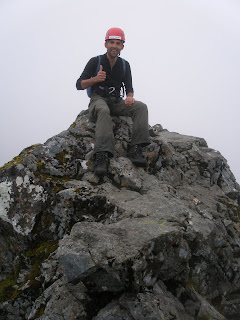
And myself:

The gap in which The Great Stone Shoot starts:

Getting down to the shoot:

Andrew starting down the shoot:

Watch out for loose rocks:


Ah Cuillins, we'll be back!

Labels: , , , , , , , ,

The Achnashellach and Torridon Hills: Beinn Liath Mhor (258) but NOT Sgorr Ruadh (195)

Walk date: 18/06/09
My Munro #'s: 183

Pronunciations - translations - heights:
Byn leea voar - big grey hill - 926m
Skoor rooa - red peak - 962m

Statistics:
Duration - 11:30 - 17:30
Distance - ~12 km
Weather - awful! Extreme wet with periods of strong gusting wind. Hail too!
Team - with Paul P
Other hikers: four other idiots

So close yet so far, the weather kept us off Sgorr Ruadh:


Paul P and George Skye Trip 2009 - Day 5 (Thursday)

Rest day, what rest day? With a day off from the guided routes on Skye, Paul and I drive out to Achnashellach to try and visit the only two hills I haven't been on in this range. The weather was forecast to be on the bad side so we'd changed a planned circular route (also plotted on map) to a T-shaped walk to reduce the exposure as much as possible.

The walk starts by passing through Achnashellach station and rising on a forestry track through pinewood. The track soon levels and then has to be left by taking a cairn-marked path to the left down to the riverbank. From here the path is constant and takes you up onto heathery hillsides and into Coire Lair (avoiding the paths that branch off for the circular version of the walk).

It was entering Coire Lair that the weather started to go bad with the rain starting to pour down heavily. We pushed on upwards including a thin river crossing over thundering waters and made for the bealach. In what was now high wind and hail we missed a path that runs down the south-west ridge of Beinn Liath Mhor and continued over the bealach, eventually getting onto the ridge by climbing up wet grassy slopes besides a thin watercourse from the north-west.

Once up on the ridge we were at the mercy of the wind, but the way was broad enough to continue and we picked our way up between rocky slabs until we hit the path we'd missed just below the final push for the summit.

Stepping on over loose rocks we were soon sat on the drenched top enjoying the moment but with no shelter whatsoever for reward. We were however quite pleased not to have come on the circular version of the hike as the ridge ahead looked to be quite thin in sections.

After a brief stop we quickly moved on out of quite so much exposure, descending on the path that was now obvious all the way back to the bealach. Once there, due to the ease of missing this path when visibility was reduced, I built a mini-cairn at the branch point hoping that it would help future adventurers out.

Speaking of adventure however, our appetite was over for the day. After adventuring against the weather for some hours, despite the proximity of Sgurr Ruadh, Paul and I decided together that enough was enough and we cut our loses, making for the haven of the car in a quickmarch down the glen. An exhilarating day out but one that we knew had come to a close!


Sgurr Ruadh (L) and Beinn Liath Mhor (R):

There's a reason this land is so green!

Our invented route up onto BLM:

The end in sight, a much deserved Beinn Liath Mhor:

I think I had every piece of equipment on by this time:

Still raining:

Sgurr Ruadh looking tempting but very wet:

Relaxing on top of Beinn Liath Mhor:
Lamenting forgetting the picnic blanket:

Labels: , , , , ,

Skye: Bla Bheinn (252)

Walk date: 17/06/09
My Munro #'s: 182

Pronunciations - translations - heights:
Blaa-vin - possibly blue hill or warm hill - 928m


Statistics:
Weather - a few spots of rain and a little wind but could have been a lot worse!
Team - with guided group.
Other hikers: none!


Paul P and George Skye Trip 2009 - Day 4 (Wednesday)

Despite a deluge overnight and waking up to wild wind and rain, our 9am phonecall to the guide still lead to our meeting up for a hike, this time a reasonable 10:30 for a drive from the Sligachan around to Loch Slapin to take on Bla Bheinn, Skye's non-Cuillin Munro.

The biggest danger on this day was faced immediately as, upon opening the car door, swarms of virulent Scottish midge swooped down to feed on us. With the gear hurriedly slapped on, we paced away from the blighters on the good path climbing slowly into the glen ahead.

After a river crossing which was ok even with all the overnight rain, the path starts to climb toward Coire Uaigneich. The going remains fine despite the increased incline; the only tricky aspect is to remember to leave what appears to be the obvious route to turn back on yourself slightly and begin a more scrambly path that progresses up the broad ridge to the right of Bla Bheinn's deep gully. Any navigation is helpfully made more difficult by magnetic rock on this hill too! Nonetheless, if you find it, this ascent gives excellent views to Clach Glas.

From the top if the weather is good you are rewarded with superb views over to the whole Cuillin ridge which gives this hill a flavour that the main ridge is lacking. Bla Bheinn definitely proved to be a worthy day out especially as the weather wasn't perfect, although it should be noted that it could cause some problems if the cloud is down.


Escape from the midge, onward!

Starting the climb toward Coire Uaigneich:

Scrambling up toward the summit:

A grand view to the Cuillins, Gillean to the right:

Looking back toward Garbh-bheinn:
Myself modeling the main ridge:
Just hanging about at 928m:
Navigation made harder on this one!
Sun greeting our return:

Labels: , , , , , ,