Sunday, June 21, 2009

Skye; The Cuillins: Sgurr nan Eag (265), Sgurr Dubh Mor (228) and Sgurr Alasdair (154)

Walk date: 19/06/09
My Munro #'s: 184, 185 and 186

Pronunciations - translations - heights:Skoor nan ayg - peak of the notches - 924m
Skoor doo moar - big black peak - 944m
Skoor alastar - Alexander's Peak (named after Sheriff Alexander Nicolson who made the first ascent in 1873) - 992m

Statistics:
Weather - periods of wet and wind, but also long periods of calm to recover in.
Team - with guided group
Other hikers: 3, also from Youth Hostel


Paul P and George Skye Trip 2009 - Day 6 (Friday)

Despite low cloud and a damp forecast, we still buckled up for this last day of the guided week, today heading up onto the southern end of the ridge. From the campsite in Glenbrittle, we headed up into Coir a' Ghrunda which entailed reasonable scrambling from early on, again making us thankful to be in a guided group especially with the weather closed in.

Finally we made it to the loch and a return to some flat walking, but soon we were hiking upwards again, albeit on an easier path, and reaching the ridge once more. It was here that we first met some fellow hikers who were also staying at the Youth Hostel and who had discussed with us their plans for a 2-day ridge traverse. We were to see these people at intervals for the rest of the day; it turned out that despite their technical prowess (ropes, climbing skills etc.), they had met their challenge with route-finding on the clagged-in Cuillins, and indeed resorted to following our group on several occasions. It was a fine example of the danger of these hills being multi-layered and able to catch out even experienced hikers.

Once onto the ridge, Sgurr nan Eag involved some winding scrambling but nothing too taxing. It was however extremely wet at this point and the prospect of spending the rest of the day like that was a depressing one. We then retraced our steps before pushing on past Caisteal a' Garbh-coire and then beginning more serious scrambling up onto Sgurr Dubh an Da Bheinn.

The bags were then happily dumped before heading for some more fine scrambling on the way to Sgurr Dubh Mor, which was difficult in places with challenging route-finding if you didn't know the way already. Thankfully, once perched around the sharp summit, the clouds lifted and gave us fantastic views all around. I was quite struck at this point by how close Sgurr nan Eag was as it had felt like some distance in the cloud.

The break in the weather was to last a good hour and allowed us warm and pleasant walking to the base of Sgurr Alaisdair passing the great gouge of the TD gap. A final session with the rope for a difficult scramble got us up onto this highest point of Skye and the last Munro of the course. By this time the cloud was back but it still felt great to sit on the summit and think of all that had been done over the week.

From the summit easy walking lead down to the top of The Great Stone Shoot, a thousand feet of scree that looks impossible either as an ascent or a descent from across the corrie. Actually being on it is not so bad, although going in a group meant a much more controlled rate of descent which I found much harder than just 'letting go' like usual. Eventually however it does end and from the base easy walking took us away from the Cuillins for the final time. A steak dinner in the Carbost Inn with some of the rest of the group that evening was a perfect cap to a fantastic week of fantastic hills.

Chance of cloud-free Munros?

Finally reaching some flat walking in Coir a' Ghrunda:


Sgurr nan Eag in the wet:

Rain in action:

There was a distinct lack of shelter:

The rain did not dampen the mood:

Rocks in the mist on Sgurr Dubh Mor:

Impressive features on the same:

The push to Sgurr Dudh Mor's summit:

Is that a view? Clouds part on Sgurr Dudh Mor:

Views to the north:

Alasdair and Choinnich beyond the guide:

More of Choinnich:

More thin paths:

Alasdair poking through:

And the In Pin makes an appearance:

Alasdair here we come:

Looking sharp close up:

The TD gap from below:

Heading for the climb:

Looking back at the day's work:

That's our route up:

Getting down with the scrambling:

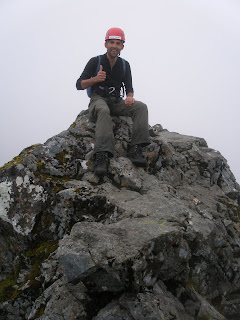
Paul on Sgurr Alasdair:

And myself:

The gap in which The Great Stone Shoot starts:

Getting down to the shoot:

Andrew starting down the shoot:

Watch out for loose rocks:


Ah Cuillins, we'll be back!

Labels: , , , , , , , ,

Skye: Bla Bheinn (252)

Walk date: 17/06/09
My Munro #'s: 182

Pronunciations - translations - heights:
Blaa-vin - possibly blue hill or warm hill - 928m


Statistics:
Weather - a few spots of rain and a little wind but could have been a lot worse!
Team - with guided group.
Other hikers: none!


Paul P and George Skye Trip 2009 - Day 4 (Wednesday)

Despite a deluge overnight and waking up to wild wind and rain, our 9am phonecall to the guide still lead to our meeting up for a hike, this time a reasonable 10:30 for a drive from the Sligachan around to Loch Slapin to take on Bla Bheinn, Skye's non-Cuillin Munro.

The biggest danger on this day was faced immediately as, upon opening the car door, swarms of virulent Scottish midge swooped down to feed on us. With the gear hurriedly slapped on, we paced away from the blighters on the good path climbing slowly into the glen ahead.

After a river crossing which was ok even with all the overnight rain, the path starts to climb toward Coire Uaigneich. The going remains fine despite the increased incline; the only tricky aspect is to remember to leave what appears to be the obvious route to turn back on yourself slightly and begin a more scrambly path that progresses up the broad ridge to the right of Bla Bheinn's deep gully. Any navigation is helpfully made more difficult by magnetic rock on this hill too! Nonetheless, if you find it, this ascent gives excellent views to Clach Glas.

From the top if the weather is good you are rewarded with superb views over to the whole Cuillin ridge which gives this hill a flavour that the main ridge is lacking. Bla Bheinn definitely proved to be a worthy day out especially as the weather wasn't perfect, although it should be noted that it could cause some problems if the cloud is down.


Escape from the midge, onward!

Starting the climb toward Coire Uaigneich:

Scrambling up toward the summit:

A grand view to the Cuillins, Gillean to the right:

Looking back toward Garbh-bheinn:
Myself modeling the main ridge:
Just hanging about at 928m:
Navigation made harder on this one!
Sun greeting our return:

Labels: , , , , , ,

Skye; The Cuillins: Sgurr nan Gillean (191), Am Basteir (242) and Bruach na Frithe (200)

Walk date: 16/06/09
My Munro #'s: 179, 180 and 181

Pronunciations - translations - heights:
Skoor nan geelyan - peak of the young men - 964m
Am Bastar - meaning obscure - 934m
Brooach na freea - slope of the deer forest - 958m

Statistics:
Weather - dry but windy, cold when exposed.
Team - with guided group.
Other hikers: a few but quiet.


Paul P and George Skye Trip 2009 - Day 3 (Tuesday)

Having done the In Pin, we understandably thought that the main difficulty for the week was over with, but we hadn't considered the west ridge of Sgurr nan Gillean. With the chance of another fine, or at least dry day, our guide decided to take us on the other 'hard day'. Despite it being referred to in this way we really couldn't get as excited about it as we had the infamous In Pin, but that was before actually seeing it in the flesh!

Setting off from the Sligachan Hotel and heading toward the Cuillin ridge via Coire a' Bhasteir (with impressive views of the Pinnacle ridge to our left) we were soon stood, roped up again, having climbed up a good scrambly chimney and facing the prospect of three relatively easy but extremely exposed moves which lay between us and the west ridge of Gillean.

The moves were necessary to progress us past two pinnacles; the first had to be skirted around on thin footholds, then there was a step across to the second with big drops continuing beneath, and then a climb up the side of the second! There's something distracting about looking for a place to put your foot and seeing a drop of some few hundred feet on either side of it!

Just the description from the guide was daunting enough, and Paul and I gave each other that 'what the hell?' look, but with Jeff, 69 and Enid, 63 setting off in front and making good, albeit cautious progress, it wasn't the time for two supposedly hardy young(ish) lads to hesitate. It was definitely more daunting than the In Pin, but again with the rope for security and the reassurance from the guide we were soon past it and sitting securely beyond the next few boulders. Apparently the route used to be even harder when a boulder called the 'Gendarme,' stood there blocking the way!

The rest of the way was fine although it did include some rather polished stone at one stage with little chance of stopping if you mistimed the rather precise 'path'. From the summit our guide did point out the 'tourist route', which ascends up the south-eastern ridge and apparently doesn't go beyond a decent scramble; it ends with what looked like quite flat ground, but ground extremely exposed down both sides. It seemed like something I would be up for in dry and not too windy weather, but anything else would require a cancellation!

We retraced our steps down the west ridge but abseiled down the next chimney (Nicholson's) over from the one we climbed up, thus avoiding the exposed moves again.

Next up was the formidable looking Am Basteir. Earlier in the day we had watched some hikers attempt the ridge crest toward the summit only to abandon its exposure including the notorious 'bad step' from which deaths have occurred. Fortunately, our guide knew of a fantastic 'avoidance route' to the south side which joins onto the crest just after the bad step. With this route the progress was actually easy although it should be mentioned that the peak is still sharp and that this is no summit for much of a gathering!

We then returned to Bealach Basteir and skirted around the base of Am Basteir and the fierce looking tooth to rejoin the ridge and stroll onto Bruach na Frithe. After the excitement of the first two peaks of the day, Bruach na Frithe was almost disappointing. Anywhere else it would be a fine peak but it is very much in the shadow of its neighbours here.

With the avoidance route on Basteir, that and Bruach na Frithe are fine peaks for the non-technical hiker, but Gillean from the west (and certainly along the pinnacle ridge!!!) should not be attempted by anyone not comfortable with big exposure. It is not a peak for attempting without prior knowledge either as the actual route looks insane as it is. Being in a group, taking advice and doing reconnaissance are all recommended. Having said that I am up for making a cautious trip along the tourist route in future having seen reportedly its worst part. Watch this space!

A good looking morning for the Northern 3:
The Pinnacle ridge is not for the beginner:
The Red Cuillin looking good as we climb:
Am Basteir in the middle with the tooth on its right:

Knight's Peak on the Pinnacle ridge:

It's getting rocky now! Gillean's west ridge:
Just before the climb, no more path!
Here we go again:
Jeff and Enid lead the way again:

After the exposed moves, with Basteir behind:

No rest for the wicked:
That's a long way down:
The guide (foreground) bringing more up:
Steve and Andrew share the relief:
Back to a good path:

Abseiling back down off Gillean:

The guide doesn't need ropes:


Resting on Basteir:

Ditto:
Basteir and the tooth from below:

Bruach na Frithe was a flat top in comparison:

Labels: , , , , , , , ,